


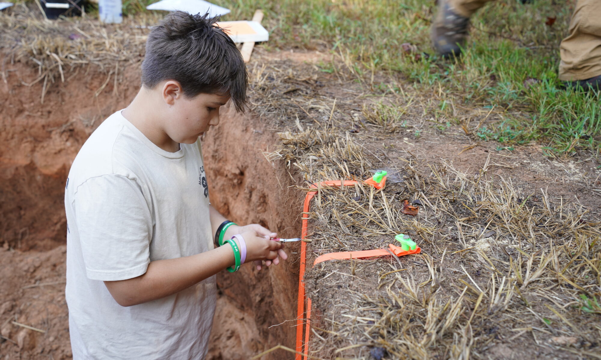
Land Judging for 4-H Members
Soils are Georgia’s most precious natural resource. Growing plants obtain their support and essential nutrients from the soil. Harvested plants supply us with food, clothing, and housing. It is essential that we conserve our soils so future generations can survive. Through land judging, you will learn what factors make one soil different from another. You will also learn conservation practices necessary to conserve the soil and make maximum use of its potential for producing crops and forage.
Land Judging ManualWhat You Will Learn in Land Judging
The different types of soil
Why soils respond differently to the same management practices
How soil properties can affect crop production and soil conservation
Water conservation practices
How to determine the best management practices for a particular soil
How to determine land use by judging soil depth, texture, permeability, slope, surface drainage, and amount of erosion
Skills for managing soil correctly
Why poor soil management can result in accelerated erosion and reduced crop yields
What You Should Do
Enroll in the 4-H Land Judging Project.
Learn the classes of land in your community.
Participate in 4-H Land Judging contests.
Other Activities
Give a soil and water conservation demonstration at school, to your club, civic groups, or other groups.
Make a soil conservation or land judging exhibit to show at a fair, school, or club.
Youth Land Judging Rules and Procedures
In Georgia 4-H Land Judging, a team is made of three or four members. The total of the top three scores made by the individual members of the team is the team score. All team members are eligible for individual and team prizes. Team members judge four sites previously selected and scored by the judges. Two of the stations are pits or holes dug to expose a soil profile. The other two stations are soil profiles that have been transferred into trays. Two of the stations will represent North Georgia and two will represent South Georgia. From the soil profiles, contestants determine the texture, depth, permeability,
degree of erosion, and drainage. At the station with the pit, two wooden stakes are set up where the contestants measure slope. For the tray stations, the station card will provide needed information for slope. Buckets of topsoil and subsoil are provided for soil texture at each station. These samples are especially important for the two stations with soil profiles in trays.
Competition Guidelines
1. The Junior Competition is for 4th – 8th grade youth. The Senior Competition is for 9th – 12th grade youth. A county may bring a maximum of 20 youth for each competition level to the state contest. Counties may have up to 3 teams per competition level. Teams must be designated prior to the contest. If a county has less than three contestants, they may participate as individuals.
2. Teams will judge 4 stations that include both North and South Georgia soils – either in pits or in trays. Youth may not touch soil in trays but may manipulate the same soil provided for judging purposes. Contest officials will provide specific instructions for handling soils in pits.
3. Youth will have a maximum of 20 minutes at each of the 4 stations.
4. Participants complete a 2-part scorecard based on soil classification and use.
5. While blank paper is allowed, notes and cell phones are prohibited.
6. The top 4 participants in each competition level will be named the winning team, with the top three scores counting.
7. Ties in team competition will be broken by the aggregate score of the top three team members for station 1, followed by station 2, 3, and 4, if needed.
8. Ties in individual competition will be broken based on the highest individual score for station 1, followed by stations 2, 3, and 4, if needed.
What to Bring/Equipment
1. Pencil(s) with eraser
2. Clipboard
3. Yard stick/ ruler
4. Trowel/small probe/putty knife for checking soil characteristics
5. Calculator, but all personal memory must be cleared before the contest
6. Towel or rag
7. Slope Finder
The Score Card
Each team member receives four scorecards, one for each station. The top of each scorecard should have the contestant’s name, number, and county. Answers to all parts must be properly and clearly marked with an X so there is no doubt as to which square was marked. The scorecard is divided into two parts. Part 1 deals with the land and soil conditions. Part 2 determines how the land will be used based on land classes.
Part 1
Land judging is done with a scorecard prepared by soil scientists. The scorecard suggests standards for each characteristic of the soil. The Land Capability Classification (LCC) System is a land evaluation ranking that groups soils based on their potential for agricultural and other uses, also taking into consideration the risks for degradation. The resulting LCC, as determined by the seven characteristics evaluated, is also graded on the scorecard.
The characteristics are:
1. Topsoil texture
2. Topsoil thickness
3. Effective depth-topsoil and subsoil
4. Permeability-subsoil
5. Slope
6. Erosion
7. Drainage
8. Land Capability Classes
Part 2
This part of the Georgia 4-H Land Judging Placing Card concerns recommended practices for different land classes at each designated station in the Land Judging Contest. Youth must decide what practices are needed to conserve soil and water and maintain or improve productivity for the area. The decisions must be made at each station and recorded in the proper column.
Part 2 is divided into three divisions:
1. Vegetative-Contains 13 suggested practices.
2. Mechanical -Five practices numbered 14 through 18.
3. Lime and Fertilizer-Numbers 19-25 are lime and fertilizer practices to consider for each site.
The practices needed to conserve soil and water and maintain or improve productivity are to be selected and recorded. In the state contest youth will be told how many total practices are needed.
Station Card
At each station there will be a station card with information necessary to complete the scorecard. Conditions and information generally given on the station card are as follows:
1. Station Number: ______
2. Rotation: ______
3. Original Topsoil Thickness: ______
4. Slope: Feet fall per 100ft = ______ feet
5. Gullies: ______
6. pH is: _______
7. Manure is: _______
8. Phosphorus is: ______
9. Potassium is: ______
10. Magnesium is: ______
11. Check______ Items
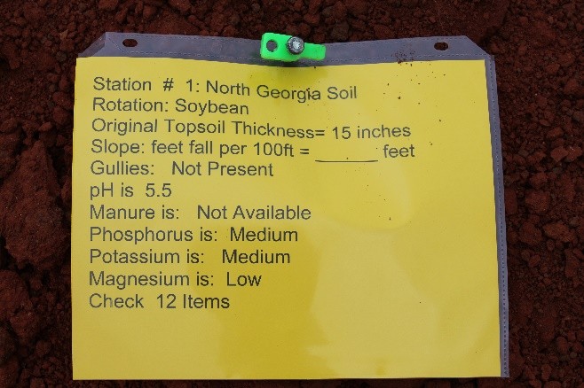
Example of Station Card
Part 1: Soil Characteristics
Topsoil Texture
Texture is determined by the proportion of sand, silt and clay in the topsoil. The largest particles are sand. Clay particles are the smallest. Silt particles are smaller than sand but are larger than clay particles. Topsoil texture is not determined by size of sand particles.
Soil Textural Triangle
There are 12 soil texture classes on the triangle. You can find the soil texture if you know the percentage of sand, silt, and clay in your sample. For example, a soil with 40% sand, 20% clay, and 40% silt would have a soil texture class of loam. The triangle will give you the range of particle sizes if you know the type of soil texture.
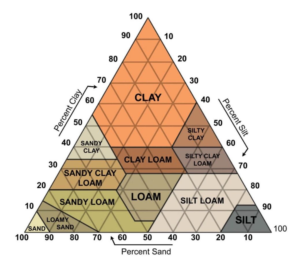
There are 12 soil texture classes on the triangle. You can find the soil texture if you know the percentage of sand, silt, and clay in your sample. For example, a soil with 40% sand, 20% clay, and 40% silt would have a soil texture class of loam. The triangle will give you the range of particle sizes if you know the type of soil texture.
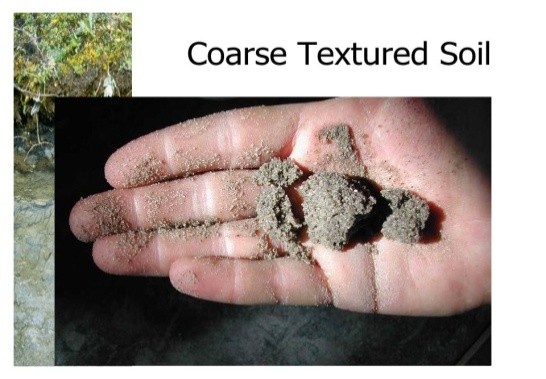
Coarse
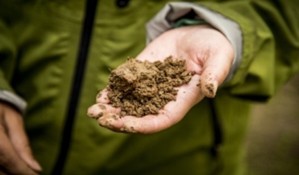
Coarse (sandy) soils are mostly composed of sand particles. Sand is the gritty material, which is felt when the soil is rubbed between the fingers. Individual grains can be readily seen or felt. Coarse textures feel and sound gritty, make no ribbon, and the soil crumbles when the soil is handled. Textural classes: Sand and Loamy sand.
Medium
Medium-textured soil is between fine and coarse in texture. Soils feel smooth or like flour. It can be molded and when moist it will form a ribbon that is 1 cm to 5 cm in length. The ribbon will easily break. Texture Classes: sandy loam, silt, silt loam, loam, sandy clay loam, clay loam, and silty clay loam.
Fine
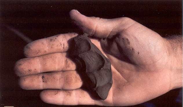
Fine-textured (clayey) soils form very hard, massive clods or lumps when dry. When moist, the soil can be squeezed out between the thumb and forefinger to form a 5cm or longer ribbon with a shiny surface. The soil can be stiff and difficult to make the ribbon. Texture Classes: clay, silty clay, sandy clay.
Typical Soil Profile
A vertical section through the soil is a soil profile. It is divided into three principal layers: topsoil, subsoil and parent material. These layers may differ from one another by either color or texture.
1. Topsoil or “A” horizon is a mineral surface soil which has accumulated decomposed organic matter and is usually darker in color than lower layers. It is also the horizon that has lost clay, iron, and aluminum due to downward movement.
2. Subsoil or “B” horizon is a mineral horizon that usually has finer texture, or a darker, redder color and a distinctly different developed structure than the “A” horizon.
3. Parent material is either weathered to form a “C” horizon or is solid bedrock known as a “R” horizon. A “C” horizon is a mineral horizon of weathered parent material that does not form developed structure like seen in the “B” horizon. A “R” horizon is a layer of bedrock, solid rock. Bedrock is often absent in many soil profiles.
Topsoil Thickness
Topsoil is the surface layer of the land measured from the top, or ground level, down to the point of change, or the beginning of the subsoil. Color or texture determines the point of change between topsoil and subsoil. Some soils in the southern half of the state have thick, very thick, or extremely thick sandy topsoil. The plow layer is only in the upper part; the lower part may be 20 to 30 inches thick.
Topsoil Thickness Categories:
Thin – Less than 5 inches.
Moderately Thick – At least 5, but less than 10 inches.
Thick – At least 10, but less than 20 inches.
Very Thick – At least 20, but less than 40 inches (coarse texture.)
Extremely Thick -At least 40 inches (coarse texture)
Effective Depth-Topsoil and Subsoil
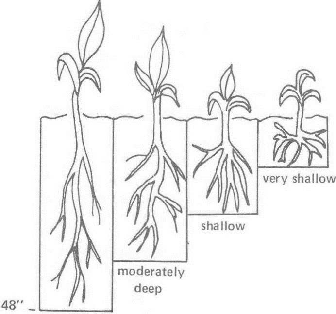
Effective depth of topsoil and subsoil is that depth to which plant roots can easily penetrate and absorb water and plant nutrients. The goal is to determine if there are restrictive layers that prevent plant roots from penetrating the soil. Common restrictive layers are rock layers, dense chert layers, gravel layers, hardpans, claypans, or plow pan layers. Plant roots usually cannot penetrate these layers.
Effective Depth Categories:
Deep – At least 40 inches.
Moderately Deep – At least 20, but less than 40 inches.
Shallow – At least 10, but less than 20 inches.
Very Shallow – Less than 10 inches.
Structure
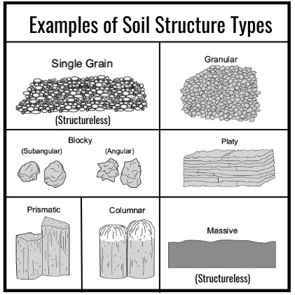
Soil structure is not judged; however, it is very important because it affects permeability and how well plants can grow. Structure means the shape and arrangement of soil particles into clusters. Each cluster has a particular shape or size and determines the type of soil structure. It is best to observe structure from the soil profile rather than soil trays due to disturbance.
Structure Categories:
Single Grained – each soil particle functions as an individual unit due to the lack of binding materials. This structure condition is usually found in coarse-textured soils.
Granular – sphere-like or rounded clusters with no flat surfaces due to contact pressure from faces of surrounding clusters
Blocky and Subangular Blocky – block-like or clusters with around six faces having flat surfaces with mostly sharp, angular edges or rounded edges
Platy – plate-like or relatively thin horizontal plates
Prismatic – prism-like vertical clusters usually with well-defined flat surfaces or faces
Columnar – modified type of prismatic clusters but with rounded surfaces. Usually suggests salty conditions.
Massive – indistinct or no apparent clusters. Characteristic of clayey, very slowly permeable soils.
Permeability of Subsoil
Permeability is the rate of movement of water and air through the soil. Permeability is important because it determines the kind of crops that can be grown, how soon the soil can be worked, the benefits received from fertilizers, and the absorption of nutrients and water by plants. The water and air movement in soils is influenced by many factors such as soil texture and structure, degree of soil density, and presence of restrictive layers. One of the best clues to soil, air, and water relationships is the color of the subsoil. For
contests, the subsoil texture sample will be used to determine the permeability. The color of most subsoils is determined by iron compounds. When soils are well aerated, the iron compounds are in an oxidized form, giving the subsoil a red or yellow color. In a poorly aerated soil, the iron compounds will be in a reduced state (lack of oxygen), and the subsoil color will be gray. Mixed or mottled colors of gray, yellow, and brown will frequently appear.
Permeability Categories:
Rapid – Soils with coarse-textured subsoils that are granular or single grained structure. These soils exhibit little restriction of water or air.
Moderate – Soils with medium-textured subsoils with good structure (ex: blocky structure). Water and air movement is good. Plant roots are abundant and penetrate easily through the soil. Subsoil colors are often bright red or yellow.
Slow – Soils with fine textured subsoils with angular and subangular blocky structure. These subsoils are firm and sticky when moist and hard when dry. Soil clusters often have thin, discontinuous clay films. Subsoil colors can be gray or mixed gray with yellow, brown, or orange.
Slope of Land
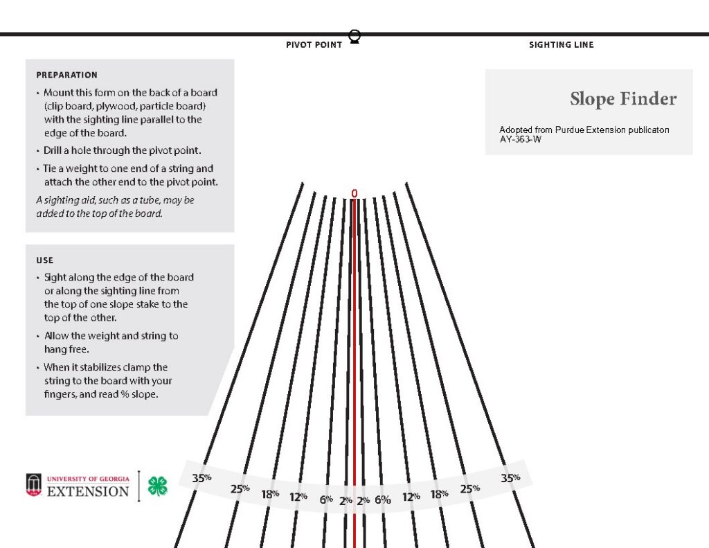
Slope refers to the steepness of the area. The slope is important because it has great influence on how fast water runs off a field and the amount of soil erosion that occurs. Percent slope is determined by estimating the number of feet fall per 100 feet. For example, if the feet fall per 100 feet is 5, the percent
slope is 5%. Contestants will measure slope between two stakes near the soil pit. Slope can be found with eye or a slope finder (see Appendix B). Stakes should be the same height, but always check before shooting slope. The stakes are set 100 feet apart unless there is not room. Stakes will be 50 feet when space is limited. Youth will be informed of distance. There are the two ways to shoot slope:
1. Shoot from top of one stake and see where eyes hit the other stake. For every 12 inches down (stakes 100 feet), 1% slope.
2. From one stake, sight along the sighting line of the slope finder to the top of the second stake. Allow the weight and string to hang free. When it stabilizes, clap the string to the board with your fingers, and read percent slope.
Categories for Judging Slope:
| South Georgia | North Georgia | |
| Nearly Level | 0 – 2% | 0 – 2% |
| Very Gently Sloping | 2+ – 5 % | 2+ – 6% |
| Gently Sloping | 5+ – 8% | 6+ – 10% |
| Sloping | 8+ – 12% | 10+ – 15% |
| Strongly Sloping | 12+ – 17% | 15+ – 25% |
| Steep | Above 17% | 25+ – 60% |
| Very Steep | Not Applicable | >60% |
Erosion
Soil erosion is an expression of the harmful effects of water and wind on the soil. Loss of soil by erosion reduces the productivity of the soil in addition to polluting streams. The amount and severity of soil erosion can be expressed in four general categories or classes: slight, moderate, severe, very severe. These are described below and can be recognized in the field after limited study. You will be provided with the original topsoil depth of each station.
Formula: Topsoil depth found in the pit (or tray) is 6 inches. Original topsoil depth given on card is 10 inches.
{[Original topsoil (in) – Measured topsoil (in)]÷Original topsoil (in)} x 100 =
[(10-6)÷10] x 100 = 40% erosion
Erosion Classes
None to Slight – The topsoil generally is friable and retains much of the dark color of the original surface layer; it is moderately thick or thicker; the subsoil is not exposed unless by unusually deep (10″ +) plowing; no gullies are present. Less than 25 percent of the original topsoil has been lost.
Moderate – The topsoil may be thin with much of the original surface layer lost; the subsoil is exposed in many places over the field; a few shallow gullies and rills may be present. The color is more nearly that of the subsoil. Between 25 and 75 percent of the original topsoil has been lost.
Severe – The surface is mainly exposed subsoil and only remnants of the original surface layer remain; gullies two to three feet deep may be scattered over the field. Seventy-five percent or more of the original topsoil and as much as 25 percent of the subsoil have been lost.
Very Severe – Essentially gullied land. Gullies are closely spaced and only remnants of the original soil profile remain between the gullies. Land uses are severely limited. All of the original topsoil and 25 to 75 percent of the subsoil is lost.
Drainage
Soil drainage is the process whereby excess water is removed from the soil. For proper plant growth, air and water must move freely in both the surface soil and subsoil. In addition, the soil must be able to hold and store sufficient water for plant growth. However, excess water should drain out. This allows room for air that is needed for root respiration. Respiration furnishes the energy for plants to absorb water and plant nutrients. If there is no air in the soil for a long time, the soil color becomes dull gray. If air is lacking for only a part of each season, the subsoil creates redoximorphic features (mixed yellow, orange, red, and gray colors). That is, it has splotches or depletions which are dull gray where minerals have been removed from Soil depletion as sign of poor drainage the soil. Be careful not to confuse lime deposits or spots of disintegrating parent material in otherwise bright red or yellow subsoil with depletions. As the color changes from dull gray; to a mixed color of gray, yellow, orange and brown; and then to bright red or yellow, internal drainage becomes better.
Drainage Classes
Excessively Drained – Coarse, sandy materials, more than 60 inches deep.
Well-Drained – No gray depletions in top 30 inches of soil profile.
Moderately Well-Drained – No gray depletions in top 20 inches, but present in 20-30-inch zone.
Somewhat Poorly-Drained – Gray depletions in top 20 inches.
Poorly-Drained – Soil is usually gray to surface; subsoil is always predominately gray.
Extremely Poorly-Drained – soil is frequently wet to surface
Land Capability Classes
In Georgia 4-H Land Judging, the land class will be determined by the “Guidelines for Selecting Land Capability Classes” on page 16 of the manual. The following list is a summary of the eight land classes which will be considered. A combination of factors which may cause the land class to be raised to a higher number will not be considered.
Class 1 land is very good land from all points of view.
Class 2 land is good from every standpoint, but certain physical conditions make it not quite as good as Class 1.
Class 3 is moderately good land for cultivation. It is more limited in its use than Class 2.
Class 4 land is good enough for occasional cultivation under careful management.
Class 5 land is not subject to erosion, but is poorly drained.
Class 6 land is not suited for any cultivation and is limited in use to pasture or trees.
Class 7 land has severe limitations that restrict its use to pastures or trees.
Class 8 land is suited only for wildlife or recreational purposes. Stone Mountain is a good example.
Description of the Land Capability Classes
The Natural Resources Conservation Service has designed a system for classifying land according to its best use. This system is called land capability class. It is a scheme for grouping fields or areas with similar hazards. There are eight (1, 2, 3, 4, 5, 6, 7, 8) land capability classes.
The eight land capability classes can be divided into two broad groups:
1) land suited for crop production–Classes 1, 2, 3, 4
2) land suited only for permanent vegetation such as pasture or forest–Classes 5, 6, 7, 8.
The Classes
Class 1. Class 1 land is very good land with no hazards and can be used for production of crops. Some possible characteristics for Class 1 land include:
1. The slope is level or nearly level.
2. Topsoil thickness may be either thick or moderately thick.
3. Erosion is none to slight.
4. The texture of topsoil is coarse or medium.
5. Permeability of the subsoil is moderate.
6. It is well drained and not subject to overflow.
7. The effective depth is deep.
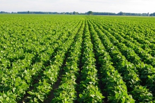
Example of Class 1 land. It is well drained and nearly level with no hazards for crop production.
Class 2. Class 2 land is also suitable for crop production, but certain hazards put it in a higher class. Some possible characteristics for Class 2 land include:
1. The slope may be either nearly level or very gently sloping. If it is nearly level, factors other than slope cause it to be Class 2 instead of Class 1.
2. The topsoil thickness may be very thick, thick, moderately thick, or thin. If it is very thick or thin, the best possible Class is 2.
3. Erosion may be either slight or moderate.
4. Topsoil texture may be coarse, medium or fine. If it is fine, the best possible Class is 2.
5. The permeability of the subsoil may be either moderate or slow. If it is slow, it could not be better than Class 2.
6. It may be well drained or moderately well drained. If it is moderately well drained, the best class it can be is Class 2.
7. The effective depth may be either deep or moderately deep.
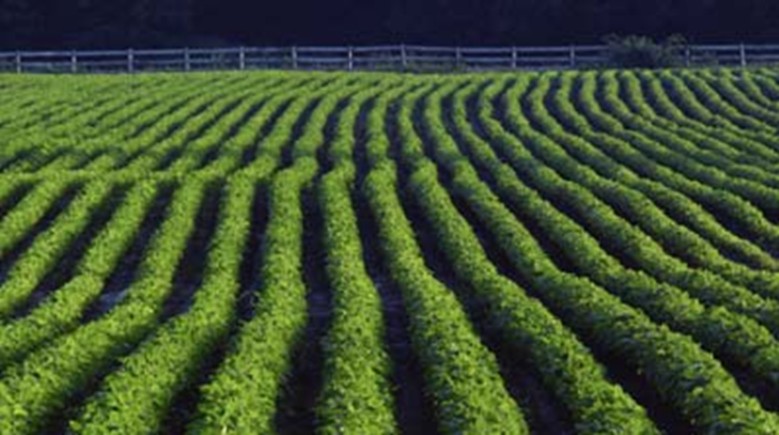
Example of Class 2 land. A moderate erosion hazard but other favorable features make this land Class 2.
Class 3. Class 3 land may be used for crop production if certain practices are followed. It has more hazards than Class 2 land and its use for crop production is more limited than Class 1 or 2 land.
Possible characteristics of Class 3 land include:
1. The slope may be nearly level, very gently sloping, or gently sloping. If it is gently sloping, Classes 1 and 2 would be eliminated and it could not be better than Class 3.
2. The topsoil thickness may be extremely thick, very thick, thick, moderately thick, or thin. If it is extremely thick, the best possible Class is 3.
3. Erosion may be slight, moderate, or severe. Severe could cause it to be Class 3, by eliminating Class 2 and Class 1.
4. The topsoil texture may be fine, medium or coarse.
5. The permeability of the subsoil may be moderate or slow.
6. It may be well drained, moderately well drained, or somewhat poorly drained. If it is somewhat poorly drained, it could not be better than Class 3.
7. The effective depth of the soil may be deep, moderately deep, or shallow. If the depth is shallow, it could not be better than Class 3.
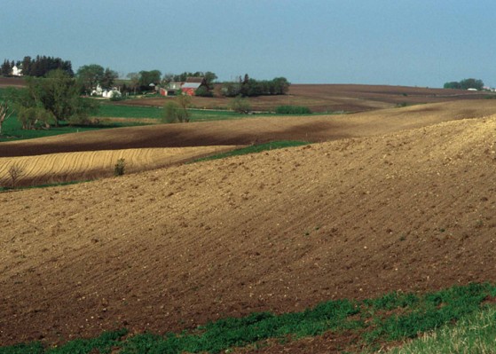
Example of Class 3 land. Steeper slopes with accompanying erosion hazard make this land Class 3. Other soils may be Class 3 because of seasonal wetness.
Class 4. Class 4 land may be used for crop production with careful management. Generally, it should be in crop production only one-fourth of the time. In the other years of the rotation, it should be in pasture or hay production. Some possible characteristics for Class 4 land include:
1. The slope of the land may be one of many nearly level, very gently sloping, or sloping. If it is sloping, it could not be better than Class 4 land.
2. The topsoil thickness may be extremely thick, very thick, thick, moderately thick, or thin.
3. Erosion may be slight, moderate, or severe.
4. Topsoil texture may be fine, medium or coarse.
5. The permeability of the subsoil may be very slow, slow, moderate, or rapid, it could not be better than Class 4.
6. Class 4 soils may be excessively drained, well drained, moderately well drained, somewhat poorly drained, or poorly drained. Excessively drained or poorly drained soils could not be better than Class 4.
7. Class 4 soils may be deep, moderately deep, shallow, or very shallow. Very shallow soils could not be better than Class 4.
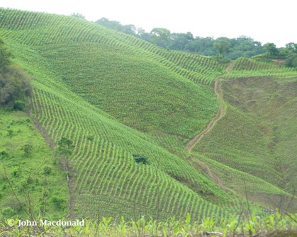
Example of Class 4 land. Steeper slopes and shallow soil put this land at the borderline of cultivatable land. It is suited for limited or occasional cultivation.
Class 5. Class 5 is a special class of soil. It may be identified as Class 5, if it is very wet to the extent that it has almost insurmountable drainage problems in removing the water. The wet surface, however, may be drained sufficiently for the production of pastures and woodlands. It is usually not necessary to consider characteristics other than very wet in identifying Class 5 for the few times that it occurs. Wet Class 5 land, however, may be nearly level or very gently sloping; moderately thick to thick topsoil; none to slight erosion; medium or coarse texture; slow permeability; and shallow to deep effective depth.
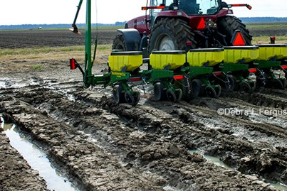
Example of Class 5 land. This land has no erosion hazard. It is wet, however, and is usually difficult to drain.
Class 6. Class 6 land is not suitable for crop production and is limited in its use for pastures and forestry. Hazards such as steep slopes, erosion, or shallow soils which cannot be corrected prevent its use for crop production. Slope and erosion are the major hazards that affect the land capability of Class 6 land. Strongly sloping land would be classified at Class 6 land.
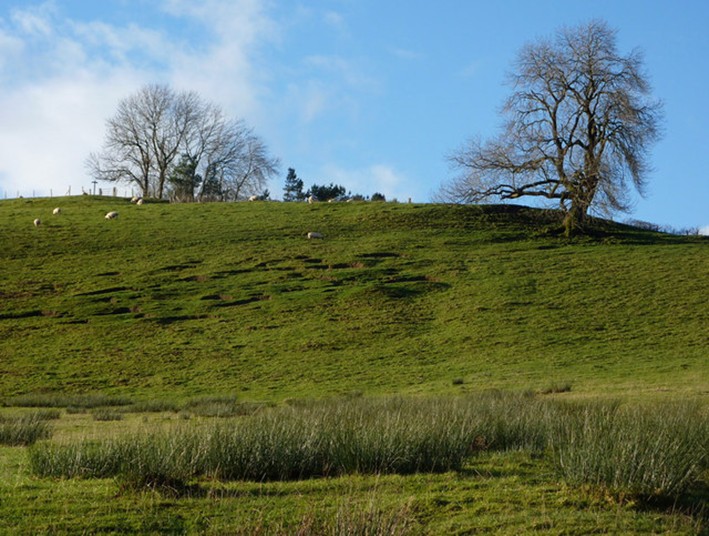
Example of Class 6 land. Steep slopes and a shallow soil create hazards that make it unsuitable for cultivated crops. It can be used for pastures or woodland.
Class 7. Class 7 land is not suitable for crop production and has severe limitations for use as pastures or for forestry. It requires extensive conservation practices to control erosion. Very severe erosion and/or slope are the major hazards which control this land capability class. Steep or very steep slopes result in a Class 7 classification.
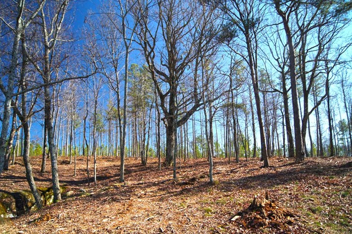
Example of Class 7 land. This land is best used for pastures or forestry.
Class 8. Class 8 land is suited only for wildlife or recreation purposes. Usually it is extremely stony, sandy, or wet. The steepness of the slope of this land makes its use for pastures marginal.
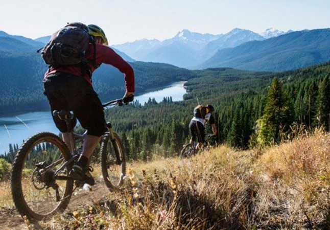
Example of Class 8 land. This land is suited only for recreation or wildlife.
The Georgia Land Judging Placing Card classifies the eight classes as follows:
Classes 1 through 4 are cultivatable.
Class 1- Very Good land from all points of view
Class 2- Good but not quite as good as Class I
Class 3-Moderately Good for cultivation
Class 4- Can be cultivated under careful management
Class 5 through 8 are not cultivatable.
Class 5- Very little slope, not subject to erosion, but poorly drained
Class 6- Suitable for permanent vegetation
Class 7- Severe for permanent vegetation
Class 8- Sandy, wet, or stony, used for wildlife or recreation
Guidelines for Selecting Land Capability Classes
| Soil Characteristics | Best Land Capability Classes | |
| Topsoil Texture: |
Fine (Clayey) |
2 1 1 |
| Topsoil Thickness: | Thin Moderately Thick Thick Very Thick Extremely Thick |
2 1 1 2 3 |
| Effective Depth: | Deep Moderately Deep Shallow Very Shallow |
1 2 3 4 |
| Permeability of Subsoil: | Rapid Moderate Slow |
2 1 4 |
| Slope: | Nearly Level Very Gently Sloping Gently Sloping Sloping Strongly Sloping Steep Very Steep |
1 2 3 4 6 7 7 |
| Erosion: | None to Slight Moderate Severe Very Severe |
1 2 3 7 |
| Drainage: | Excessively Drained Well-Drained Moderately Well-Drained Somewhat Poorly-Drained Poorly-Drained Extremely Poorly-Drained |
4 1 2 3 4 5 |
Part 2: Land Treatment
Vegetative
For cropland use on Classes 1 through 4
1. Row crop with occasional “cover crop” – use only for Class 1
2. Row crop with “cover crop” every other year – use only for Class 2
3. Row crops not more than 2 of 4 years – use only for Class 3
4. Row crops not more than 1 of 4 years – use only for Class 4
5. Return crop residue to the soil – all crop rotations
6. Practice conservation tillage provides for a protective cover by leaving crop residue of any previous crop. At least 30 percent residue should remain on the soil surface after planting. – all crop rotations
7. Control Weeds – all crop rotations and pastures
For Pasture, Range, Wildlife, or Commercial Woodland use
8. Proper pasture or range management. The application of practices to keep plants actively growing, to encourage the growth of desirable grasses and legumes while crowding out weeds/brush, and to minimize soil erosion.
9. Establish recommended grasses and legumes. – Classes 5, 6, 7 except when trees are planted
10. Control grazing. – all pastures or ranges
11. Plant recommended trees for windbreaks or woodland plantings – use for new forest areas
12. Harvest Trees selectively – use for established forests
13. Use only for wildlife or recreation area. This means protection or the development of areas that cannot be used for grazing, forestry, cultivation, or urban uses
Mechanical
For Cropland and Pasture use
14. Establish grass waterway to control erosion. – Class 2, 3, and 4 if used in rotation and slope is greater than 2%.
15. Establish terrace and farm on contour. Terrace is an embankment or ridge of earth constructed across the slope to control runoff and minimize erosion. Conduct farming operations on the contour or at right angles to slope direction. – use for all cultivated soils with slopes more than 2 percent
16. Maintain terraces. Practices that keep field terraces working effectively – use only with practice 15
17. Install drainage system. The drainage system is used to remove excess surface or ground water from land by means of surface or subsurface drains. – use on somewhat poorly, poorly, or extremely poorly drained soils that will be in crop rotation or pasture (Do not install drainage system if a wetland is present)
18. Control gullies – use when gullies (deeper than 2 feet) are present, except when land use is forestry
Lime and Fertilizer
For Cropland and Pasture use
Fertilizers and soil amendments are essential to the production of crops. Georgia soils are inherently acid and low in essential plant nutrients. Therefore, to produce high crop and forage yields, adequate lime and fertilizer must be applied to most Georgia soils. Fertility and lime requirements for a particular crop yield should be determined by soil analysis. Youth will be provided with information concerning the soil pH and fertility levels at each station.
Lime (pH)
19. Most plants require an optimum supply of nutrients and a soil pH between 6.0 and 6.5 for healthy, vigorous growth. If the soil pH is below 6.0, number 19 (lime) should be checked.
Manure
20. Manure is often used as a fertilizer source, as it contains amounts of nitrogen, phosphorus, and potassium. If manure is available (you will be provided this information), number 20 should be checked for all rotations and pastures. If check manure, do NOT check Nitrogen, Phosphorus, or Potassium since these are added with manure.
Nitrogen (N)
21. Soil nitrogen levels are generally not determined in soil analysis because it is such a mobile element in the soil. Nitrogen (number 21) should be checked for all rotations and pastures with the exception where legumes are to be grown that year, such as soybeans, peanuts, and alfalfa or where manure is available.
Phosphorus (P)
22. When soil phosphorus levels are low or medium, potassium fertilizer should be applied, mark number 22. If phosphorus is high or where manure is available, do not mark number 22.
Potassium (K)
23. When soil potassium levels are low or medium, potassium fertilizer should be applied, mark number
23. If potassium is high or where manure is available, do not mark number 23.
Magnesium (Mg)
24. When soil magnesium levels are low, magnesium fertilizer should be applied, mark number 24. If magnesium is medium or high, do not mark number 24.
Glossary
Chert: hard, fine grained sedimentary rock
Cover Crop: plant that is used to slow erosion, improve soil health, enhance water availability, and pest control. Examples include rye, crimson clover, vetch, forage radish, and more
Cultivate: prepare and use land for crops or gardening; to loosen or break up the soil for growing plants
Depletion: light gray area of soil where minerals have been removed from the soil. Often sign of limited water movement through soil.
Gully: a landform created by running water, eroding sharply into soil, typically on a hillside; resembles large ditches or small valleys
Hardpans/Clay pans: hard layer of soil, usually clay in which water has a hard time flowing though. This layer impairs drainage and plant growth
Plow Layer: top area of soil that is routinely plowed. Usually results in soil compaction and can reduce root growth
Legume: family of plants that can fix nitrogen from the air ex: soybeans, peanuts, alfalfa
Objectives of 4-H Land Judging
• To give 4-H members an appreciation of the soil and what it means to us.
• To give 4-H members the opportunity to learn soil structure, power of erosion and proper land treatment.
• To learn how land is classified according to its capabilities.
• To learn to use each acre of agricultural land within its capabilities and treat each acre in accordance with its needs for protection and improvement.