Alumni Spotlight: Dr. Julian Harris

Julian Harris at a podium

Georgia 4-H State Council culminates each year with the Citizenship Ceremony, a long-standing Georgia 4-H tradition in which recent and upcoming high school graduates pledge to participate in America’s civic process. This year’s ceremony was led by Dr. Julian Harris, a distinguished Georgia 4-H alumnus and recently-named National 4-H Luminary. He is an accomplished primary care physician and the CEO of ConcertoCare.

During his impressive career in medicine, Dr. Harris has worked as the founding President of CareAllies and served as an advisor to Google Ventures health care service. He led the healthcare team in the White House Office of Management and Budget, where he oversaw a $1 trillion budget and provided management for a range of key healthcare programs.

Dr. Harris earned his undergraduate degree from Duke University. He is also a graduate of the Wharton School of Business and the Perelman School of Medicine at the University of Pennsylvania School of Medicine, where he serves as an adjunct professor. He trained in internal medicine and primary care at Brigham and Women’s Hospital and served on the clinical faculty at Harvard Medical School.

As a Houston County 4-H’er, Dr. Harris served as the 1995-1996 President of the Georgia 4-H State Board of Directors. Georgia 4-H is proud to celebrate his recognition as a National 4-H Luminary and his commitment to supporting future generations of 4-H’ers.

Leadership in Action: County Impact

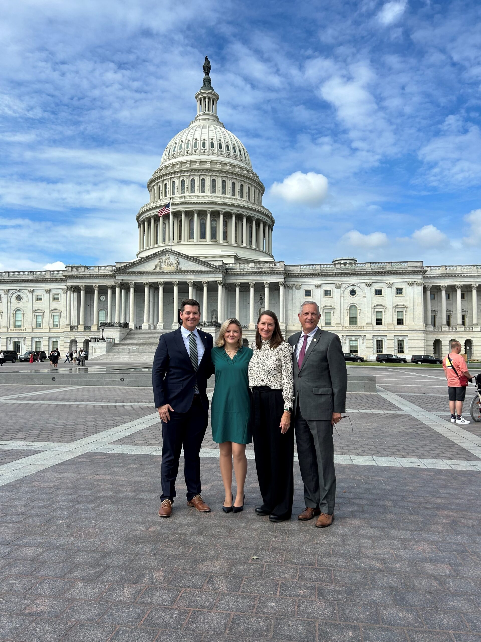
Melanie Biersmith, Lizzie Norton, Hartley Williamson, Ashley Harmon

Spalding County 4-H’er Lizzie Norton and Montgomery County 4-H’er Hartley Williamson earned top honors as state winners in the Leadership in Action project at State Congress. Leadership in Action participants identify local issues and implement thoughtful programs to meet these needs in their communities.

Upon learning that nearly 30% of local adults lack basic literacy skills and that many children living in poverty have no books at home, Lizzy was inspired to create her project, “The Book Bug.” Her goal was to expand access to books and foster a lifelong love of reading for children in her rural community, helping keep them engaged and academically successful. She initially focused on repairing and restocking neighborhood Little Free Libraries and distributing new books through her “Read & Share” cart. She then formed a team of more than 450 youth volunteers and 30 adults to address immediate literacy needs and plan for the project’s future growth. Through partnerships with local organizations, more than $50,000 in grant funding was secured to support the cause. Her team has distributed more than 13,000 books so far and educated the community about early literacy and the importance of access to books.

Lizzie Norton posing with a drill and a free library box

Hartley saw the devastating landscape damage and tree loss caused by Hurricane Helene, which inspired her to create her project, “Falling in Love with Trees, Again.” Her goal was to provide free replacement landscape trees for local homeowners, helping restore their properties after the storm. She focused on distributing trees to residents who completed a survey, prioritizing low-income families and senior citizens who could not afford replacements. She then formed a team of more than 50 youth and 28 adults to organize the distribution event and plan for the project’s growth. Through presentations to local boards and coverage in news outlets, she secured a Georgia ReLeaf grant that fully funded the project. Her team has distributed trees to 125 households and organizations so far and increased awareness about the importance of reforestation.

Hartley loading trees into a vehicle at a giveaway

Land Judging Manual

A student using tools to survey the soil during the land judging competition

Land Judging for 4-H Members

Soils are Georgia’s most precious natural resource. Growing plants obtain their support and essential nutrients from the soil. Harvested plants supply us with food, clothing, and housing. It is essential that we conserve our soils so future generations can survive. Through land judging, you will learn what factors make one soil different from another. You will also learn conservation practices necessary to conserve the soil and make maximum use of its potential for producing crops and forage.

Land Judging Manual

What You Will Learn in Land Judging

The different types of soil

Why soils respond differently to the same management practices

How soil properties can affect crop production and soil conservation

Water conservation practices

How to determine the best management practices for a particular soil

How to determine land use by judging soil depth, texture, permeability, slope, surface drainage, and amount of erosion

Skills for managing soil correctly

Why poor soil management can result in accelerated erosion and reduced crop yields

What You Should Do

Enroll in the 4-H Land Judging Project.

Learn the classes of land in your community.

Participate in 4-H Land Judging contests.

Other Activities

Give a soil and water conservation demonstration at school, to your club, civic groups, or other groups.

Make a soil conservation or land judging exhibit to show at a fair, school, or club.

Youth Land Judging Rules and Procedures

In Georgia 4-H Land Judging, a team is made of three or four members. The total of the top three scores made by the individual members of the team is the team score. All team members are eligible for individual and team prizes. Team members judge four sites previously selected and scored by the judges. Two of the stations are pits or holes dug to expose a soil profile. The other two stations are soil profiles that have been transferred into trays. Two of the stations will represent North Georgia and two will represent South Georgia. From the soil profiles, contestants determine the texture, depth, permeability,
degree of erosion, and drainage. At the station with the pit, two wooden stakes are set up where the contestants measure slope. For the tray stations, the station card will provide needed information for slope. Buckets of topsoil and subsoil are provided for soil texture at each station. These samples are especially important for the two stations with soil profiles in trays.

Competition Guidelines

1. The Junior Competition is for 4th – 8th grade youth. The Senior Competition is for 9th – 12th grade youth. A county may bring a maximum of 20 youth for each competition level to the state contest. Counties may have up to 3 teams per competition level. Teams must be designated prior to the contest. If a county has less than three contestants, they may participate as individuals.

2. Teams will judge 4 stations that include both North and South Georgia soils – either in pits or in trays. Youth may not touch soil in trays but may manipulate the same soil provided for judging purposes. Contest officials will provide specific instructions for handling soils in pits.

3. Youth will have a maximum of 20 minutes at each of the 4 stations.

4. Participants complete a 2-part scorecard based on soil classification and use.

5. While blank paper is allowed, notes and cell phones are prohibited.

6. The top 4 participants in each competition level will be named the winning team, with the top three scores counting.

7. Ties in team competition will be broken by the aggregate score of the top three team members for station 1, followed by station 2, 3, and 4, if needed.

8. Ties in individual competition will be broken based on the highest individual score for station 1, followed by stations 2, 3, and 4, if needed.

What to Bring/Equipment
1. Pencil(s) with eraser
2. Clipboard
3. Yard stick/ ruler
4. Trowel/small probe/putty knife for checking soil characteristics
5. Calculator, but all personal memory must be cleared before the contest
6. Towel or rag
7. Slope Finder

The Score Card
Each team member receives four scorecards, one for each station. The top of each scorecard should have the contestant’s name, number, and county. Answers to all parts must be properly and clearly marked with an X so there is no doubt as to which square was marked. The scorecard is divided into two parts. Part 1 deals with the land and soil conditions. Part 2 determines how the land will be used based on land classes.

Part 1
Land judging is done with a scorecard prepared by soil scientists. The scorecard suggests standards for each characteristic of the soil. The Land Capability Classification (LCC) System is a land evaluation ranking that groups soils based on their potential for agricultural and other uses, also taking into consideration the risks for degradation. The resulting LCC, as determined by the seven characteristics evaluated, is also graded on the scorecard.
The characteristics are:
1. Topsoil texture
2. Topsoil thickness
3. Effective depth-topsoil and subsoil
4. Permeability-subsoil
5. Slope
6. Erosion
7. Drainage
8. Land Capability Classes

Part 2
This part of the Georgia 4-H Land Judging Placing Card concerns recommended practices for different land classes at each designated station in the Land Judging Contest. Youth must decide what practices are needed to conserve soil and water and maintain or improve productivity for the area. The decisions must be made at each station and recorded in the proper column.
Part 2 is divided into three divisions:
1. Vegetative-Contains 13 suggested practices.
2. Mechanical -Five practices numbered 14 through 18.
3. Lime and Fertilizer-Numbers 19-25 are lime and fertilizer practices to consider for each site.
The practices needed to conserve soil and water and maintain or improve productivity are to be selected and recorded. In the state contest youth will be told how many total practices are needed.

Station Card
At each station there will be a station card with information necessary to complete the scorecard. Conditions and information generally given on the station card are as follows:
1. Station Number: ______
2. Rotation: ______
3. Original Topsoil Thickness: ______
4. Slope: Feet fall per 100ft = ______ feet
5. Gullies: ______
6. pH is: _______
7. Manure is: _______
8. Phosphorus is: ______
9. Potassium is: ______
10. Magnesium is: ______
11. Check______ Items

An example station card for land judging

Example of Station Card

Part 1: Soil Characteristics

Topsoil Texture
Texture is determined by the proportion of sand, silt and clay in the topsoil. The largest particles are sand. Clay particles are the smallest. Silt particles are smaller than sand but are larger than clay particles. Topsoil texture is not determined by size of sand particles.

Soil Textural Triangle
There are 12 soil texture classes on the triangle. You can find the soil texture if you know the percentage of sand, silt, and clay in your sample. For example, a soil with 40% sand, 20% clay, and 40% silt would have a soil texture class of loam. The triangle will give you the range of particle sizes if you know the type of soil texture.

A diagram showing the different types of soil in a triangle depending on the percentage of sand, silt, or clay

There are 12 soil texture classes on the triangle. You can find the soil texture if you know the percentage of sand, silt, and clay in your sample. For example, a soil with 40% sand, 20% clay, and 40% silt would have a soil texture class of loam. The triangle will give you the range of particle sizes if you know the type of soil texture.

Coarse
Coarse (sandy) soils are mostly composed of sand particles. Sand is the gritty material, which is felt when the soil is rubbed between the fingers. Individual grains can be readily seen or felt. Coarse textures feel and sound gritty, make no ribbon, and the soil crumbles when the soil is handled. Textural classes: Sand and Loamy sand.

An example of coarse textured soil

Medium
Medium-textured soil is between fine and coarse in texture. Soils feel smooth or like flour. It can be molded and when moist it will form a ribbon that is 1 cm to 5 cm in length. The ribbon will easily break. Texture Classes: sandy loam, silt, silt loam, loam, sandy clay loam, clay loam, and silty clay loam.

An example of medium textured soil

Fine
Fine-textured (clayey) soils form very hard, massive clods or lumps when dry. When moist, the soil can be squeezed out between the thumb and forefinger to form a 5cm or longer ribbon with a shiny surface. The soil can be stiff and difficult to make the ribbon. Texture Classes: clay, silty clay, sandy clay.

An example of fine textured soil

Typical Soil Profile
A vertical section through the soil is a soil profile. It is divided into three principal layers: topsoil, subsoil and parent material. These layers may differ from one another by either color or texture.
1. Topsoil or “A” horizon is a mineral surface soil which has accumulated decomposed organic matter and is usually darker in color than lower layers. It is also the horizon that has lost clay, iron, and aluminum due to downward movement.
2. Subsoil or “B” horizon is a mineral horizon that usually has finer texture, or a darker, redder color and a distinctly different developed structure than the “A” horizon.
3. Parent material is either weathered to form a “C” horizon or is solid bedrock known as a “R” horizon. A “C” horizon is a mineral horizon of weathered parent material that does not form developed structure like seen in the “B” horizon. A “R” horizon is a layer of bedrock, solid rock. Bedrock is often absent in many soil profiles.

Topsoil Thickness
Topsoil is the surface layer of the land measured from the top, or ground level, down to the point of change, or the beginning of the subsoil. Color or texture determines the point of change between topsoil and subsoil. Some soils in the southern half of the state have thick, very thick, or extremely thick sandy topsoil. The plow layer is only in the upper part; the lower part may be 20 to 30 inches thick.
Topsoil Thickness Categories:
Thin – Less than 5 inches.
Moderately Thick – At least 5, but less than 10 inches.
Thick – At least 10, but less than 20 inches.
Very Thick – At least 20, but less than 40 inches (coarse texture.)
Extremely Thick -At least 40 inches (coarse texture)

Effective Depth-Topsoil and Subsoil
Effective depth of topsoil and subsoil is that depth to which plant roots can easily penetrate and absorb water and plant nutrients. The goal is to determine if there are restrictive layers that prevent plant roots from penetrating the soil. Common restrictive layers are rock layers, dense chert layers, gravel layers, hardpans, claypans, or plow pan layers. Plant roots usually cannot penetrate these layers.
Effective Depth Categories:
Deep – At least 40 inches.
Moderately Deep – At least 20, but less than 40 inches.
Shallow – At least 10, but less than 20 inches.
Very Shallow – Less than 10 inches.

A diagram showing the different depths of topsoil and subsoil

Structure
Soil structure is not judged; however, it is very important because it affects permeability and how well plants can grow. Structure means the shape and arrangement of soil particles into clusters. Each cluster has a particular shape or size and determines the type of soil structure. It is best to observe structure from the soil profile rather than soil trays due to disturbance.
Structure Categories:
Single Grained – each soil particle functions as an individual unit due to the lack of binding materials. This structure condition is usually found in coarse-textured soils.
Granular – sphere-like or rounded clusters with no flat surfaces due to contact pressure from faces of surrounding clusters
Blocky and Subangular Blocky – block-like or clusters with around six faces having flat surfaces with mostly sharp, angular edges or rounded edges
Platy – plate-like or relatively thin horizontal plates
Prismatic – prism-like vertical clusters usually with well-defined flat surfaces or faces
Columnar – modified type of prismatic clusters but with rounded surfaces. Usually suggests salty conditions.
Massive – indistinct or no apparent clusters. Characteristic of clayey, very slowly permeable soils.

A diagram showcasing the different types of soil structure

Permeability of Subsoil
Permeability is the rate of movement of water and air through the soil. Permeability is important because it determines the kind of crops that can be grown, how soon the soil can be worked, the benefits received from fertilizers, and the absorption of nutrients and water by plants. The water and air movement in soils is influenced by many factors such as soil texture and structure, degree of soil density, and presence of restrictive layers. One of the best clues to soil, air, and water relationships is the color of the subsoil. For
contests, the subsoil texture sample will be used to determine the permeability. The color of most subsoils is determined by iron compounds. When soils are well aerated, the iron compounds are in an oxidized form, giving the subsoil a red or yellow color. In a poorly aerated soil, the iron compounds will be in a reduced state (lack of oxygen), and the subsoil color will be gray. Mixed or mottled colors of gray, yellow, and brown will frequently appear.
Permeability Categories:
Rapid – Soils with coarse-textured subsoils that are granular or single grained structure. These soils exhibit little restriction of water or air.
Moderate – Soils with medium-textured subsoils with good structure (ex: blocky structure). Water and air movement is good. Plant roots are abundant and penetrate easily through the soil. Subsoil colors are often bright red or yellow.
Slow – Soils with fine textured subsoils with angular and subangular blocky structure. These subsoils are firm and sticky when moist and hard when dry. Soil clusters often have thin, discontinuous clay films. Subsoil colors can be gray or mixed gray with yellow, brown, or orange.

Slope of Land
Slope refers to the steepness of the area. The slope is important because it has great influence on how fast water runs off a field and the amount of soil erosion that occurs. Percent slope is determined by estimating the number of feet fall per 100 feet. For example, if the feet fall per 100 feet is 5, the percent
slope is 5%. Contestants will measure slope between two stakes near the soil pit. Slope can be found with eye or a slope finder (see Appendix B). Stakes should be the same height, but always check before shooting slope. The stakes are set 100 feet apart unless there is not room. Stakes will be 50 feet when space is limited. Youth will be informed of distance. There are the two ways to shoot slope:
1. Shoot from top of one stake and see where eyes hit the other stake. For every 12 inches down (stakes 100 feet), 1% slope.
2. From one stake, sight along the sighting line of the slope finder to the top of the second stake. Allow the weight and string to hang free. When it stabilizes, clap the string to the board with your fingers, and read percent slope.

Categories for Judging Slope:

South Georgia North Georgia
Nearly Level 0 – 2% 0 – 2%
Very Gently Sloping 2+ – 5 % 2+ – 6%
Gently Sloping 5+ – 8% 6+ – 10%
Sloping 8+ – 12% 10+ – 15%
Strongly Sloping 12+ – 17% 15+ – 25%
Steep Above 17% 25+ – 60%
Very Steep Not Applicable >60%

A diagram to assist in the process of finding the slope of land

Erosion
Soil erosion is an expression of the harmful effects of water and wind on the soil. Loss of soil by erosion reduces the productivity of the soil in addition to polluting streams. The amount and severity of soil erosion can be expressed in four general categories or classes: slight, moderate, severe, very severe. These are described below and can be recognized in the field after limited study. You will be provided with the original topsoil depth of each station.
Formula: Topsoil depth found in the pit (or tray) is 6 inches. Original topsoil depth given on card is 10 inches.
{[Original topsoil (in) – Measured topsoil (in)]÷Original topsoil (in)} x 100 =
[(10-6)÷10] x 100 = 40% erosion

Erosion Classes
None to Slight – The topsoil generally is friable and retains much of the dark color of the original surface layer; it is moderately thick or thicker; the subsoil is not exposed unless by unusually deep (10″ +) plowing; no gullies are present. Less than 25 percent of the original topsoil has been lost.
Moderate – The topsoil may be thin with much of the original surface layer lost; the subsoil is exposed in many places over the field; a few shallow gullies and rills may be present. The color is more nearly that of the subsoil. Between 25 and 75 percent of the original topsoil has been lost.
Severe – The surface is mainly exposed subsoil and only remnants of the original surface layer remain; gullies two to three feet deep may be scattered over the field. Seventy-five percent or more of the original topsoil and as much as 25 percent of the subsoil have been lost.
Very Severe – Essentially gullied land. Gullies are closely spaced and only remnants of the original soil profile remain between the gullies. Land uses are severely limited. All of the original topsoil and 25 to 75 percent of the subsoil is lost.

Drainage
Soil drainage is the process whereby excess water is removed from the soil. For proper plant growth, air and water must move freely in both the surface soil and subsoil. In addition, the soil must be able to hold and store sufficient water for plant growth. However, excess water should drain out. This allows room for air that is needed for root respiration. Respiration furnishes the energy for plants to absorb water and plant nutrients. If there is no air in the soil for a long time, the soil color becomes dull gray. If air is lacking for only a part of each season, the subsoil creates redoximorphic features (mixed yellow, orange, red, and gray colors). That is, it has splotches or depletions which are dull gray where minerals have been removed from Soil depletion as sign of poor drainage the soil. Be careful not to confuse lime deposits or spots of disintegrating parent material in otherwise bright red or yellow subsoil with depletions. As the color changes from dull gray; to a mixed color of gray, yellow, orange and brown; and then to bright red or yellow, internal drainage becomes better.
Drainage Classes
Excessively Drained – Coarse, sandy materials, more than 60 inches deep.
Well-Drained – No gray depletions in top 30 inches of soil profile.
Moderately Well-Drained – No gray depletions in top 20 inches, but present in 20-30-inch zone.
Somewhat Poorly-Drained – Gray depletions in top 20 inches.
Poorly-Drained – Soil is usually gray to surface; subsoil is always predominately gray.
Extremely Poorly-Drained – soil is frequently wet to surface

Land Capability Classes

In Georgia 4-H Land Judging, the land class will be determined by the “Guidelines for Selecting Land Capability Classes” on page 16 of the manual. The following list is a summary of the eight land classes which will be considered. A combination of factors which may cause the land class to be raised to a higher number will not be considered.
Class 1 land is very good land from all points of view.
Class 2 land is good from every standpoint, but certain physical conditions make it not quite as good as Class 1.
Class 3 is moderately good land for cultivation. It is more limited in its use than Class 2.
Class 4 land is good enough for occasional cultivation under careful management.
Class 5 land is not subject to erosion, but is poorly drained.
Class 6 land is not suited for any cultivation and is limited in use to pasture or trees.
Class 7 land has severe limitations that restrict its use to pastures or trees.
Class 8 land is suited only for wildlife or recreational purposes. Stone Mountain is a good example.

Description of the Land Capability Classes

The Natural Resources Conservation Service has designed a system for classifying land according to its best use. This system is called land capability class. It is a scheme for grouping fields or areas with similar hazards. There are eight (1, 2, 3, 4, 5, 6, 7, 8) land capability classes.
The eight land capability classes can be divided into two broad groups:
1) land suited for crop production–Classes 1, 2, 3, 4
2) land suited only for permanent vegetation such as pasture or forest–Classes 5, 6, 7, 8.

The Classes

Class 1. Class 1 land is very good land with no hazards and can be used for production of crops. Some possible characteristics for Class 1 land include:
1. The slope is level or nearly level.
2. Topsoil thickness may be either thick or moderately thick.
3. Erosion is none to slight.
4. The texture of topsoil is coarse or medium.
5. Permeability of the subsoil is moderate.
6. It is well drained and not subject to overflow.
7. The effective depth is deep.

Example of Class 1 land. It is well drained and nearly level with no hazards for crop production.

Example of Class 1 land. It is well drained and nearly level with no hazards for crop production.

Class 2. Class 2 land is also suitable for crop production, but certain hazards put it in a higher class. Some possible characteristics for Class 2 land include:
1. The slope may be either nearly level or very gently sloping. If it is nearly level, factors other than slope cause it to be Class 2 instead of Class 1.
2. The topsoil thickness may be very thick, thick, moderately thick, or thin. If it is very thick or thin, the best possible Class is 2.
3. Erosion may be either slight or moderate.
4. Topsoil texture may be coarse, medium or fine. If it is fine, the best possible Class is 2.
5. The permeability of the subsoil may be either moderate or slow. If it is slow, it could not be better than Class 2.
6. It may be well drained or moderately well drained. If it is moderately well drained, the best class it can be is Class 2.
7. The effective depth may be either deep or moderately deep.

Example of Class 2 land. A moderate erosion hazard but other favorable features make this land Class 2.

Example of Class 2 land. A moderate erosion hazard but other favorable features make this land Class 2.

Class 3. Class 3 land may be used for crop production if certain practices are followed. It has more hazards than Class 2 land and its use for crop production is more limited than Class 1 or 2 land.
Possible characteristics of Class 3 land include:
1. The slope may be nearly level, very gently sloping, or gently sloping. If it is gently sloping, Classes 1 and 2 would be eliminated and it could not be better than Class 3.
2. The topsoil thickness may be extremely thick, very thick, thick, moderately thick, or thin. If it is extremely thick, the best possible Class is 3.
3. Erosion may be slight, moderate, or severe. Severe could cause it to be Class 3, by eliminating Class 2 and Class 1.
4. The topsoil texture may be fine, medium or coarse.
5. The permeability of the subsoil may be moderate or slow.
6. It may be well drained, moderately well drained, or somewhat poorly drained. If it is somewhat poorly drained, it could not be better than Class 3.
7. The effective depth of the soil may be deep, moderately deep, or shallow. If the depth is shallow, it could not be better than Class 3.

Example of Class 3 land. Steeper slopes with accompanying erosion hazard make this land Class 3. Other soils may be Class 3 because of seasonal wetness.

Example of Class 3 land. Steeper slopes with accompanying erosion hazard make this land Class 3. Other soils may be Class 3 because of seasonal wetness.

Class 4. Class 4 land may be used for crop production with careful management. Generally, it should be in crop production only one-fourth of the time. In the other years of the rotation, it should be in pasture or hay production. Some possible characteristics for Class 4 land include:
1. The slope of the land may be one of many nearly level, very gently sloping, or sloping. If it is sloping, it could not be better than Class 4 land.
2. The topsoil thickness may be extremely thick, very thick, thick, moderately thick, or thin.
3. Erosion may be slight, moderate, or severe.
4. Topsoil texture may be fine, medium or coarse.
5. The permeability of the subsoil may be very slow, slow, moderate, or rapid, it could not be better than Class 4.
6. Class 4 soils may be excessively drained, well drained, moderately well drained, somewhat poorly drained, or poorly drained. Excessively drained or poorly drained soils could not be better than Class 4.
7. Class 4 soils may be deep, moderately deep, shallow, or very shallow. Very shallow soils could not be better than Class 4.

Example of Class 4 land. Steeper slopes and shallow soil put this land at the borderline of cultivatable land.

Example of Class 4 land. Steeper slopes and shallow soil put this land at the borderline of cultivatable land. It is suited for limited or occasional cultivation.

Class 5. Class 5 is a special class of soil. It may be identified as Class 5, if it is very wet to the extent that it has almost insurmountable drainage problems in removing the water. The wet surface, however, may be drained sufficiently for the production of pastures and woodlands. It is usually not necessary to consider characteristics other than very wet in identifying Class 5 for the few times that it occurs. Wet Class 5 land, however, may be nearly level or very gently sloping; moderately thick to thick topsoil; none to slight erosion; medium or coarse texture; slow permeability; and shallow to deep effective depth.

Example of Class 5 land. This land has no erosion hazard. It is wet, however, and is usually difficult to drain.

Example of Class 5 land. This land has no erosion hazard. It is wet, however, and is usually difficult to drain.

Class 6. Class 6 land is not suitable for crop production and is limited in its use for pastures and forestry. Hazards such as steep slopes, erosion, or shallow soils which cannot be corrected prevent its use for crop production. Slope and erosion are the major hazards that affect the land capability of Class 6 land. Strongly sloping land would be classified at Class 6 land.

Example of Class 6 land. Steep slopes and a shallow soil create hazards that make it unsuitable for cultivated crops.

Example of Class 6 land. Steep slopes and a shallow soil create hazards that make it unsuitable for cultivated crops. It can be used for pastures or woodland.

Class 7. Class 7 land is not suitable for crop production and has severe limitations for use as pastures or for forestry. It requires extensive conservation practices to control erosion. Very severe erosion and/or slope are the major hazards which control this land capability class. Steep or very steep slopes result in a Class 7 classification.

Example of Class 7 land. This land is best used for pastures or forestry.

Example of Class 7 land. This land is best used for pastures or forestry.

Class 8. Class 8 land is suited only for wildlife or recreation purposes. Usually it is extremely stony, sandy, or wet. The steepness of the slope of this land makes its use for pastures marginal.

Example of Class 8 land. This land is suited only for recreation or wildlife.

Example of Class 8 land. This land is suited only for recreation or wildlife.

The Georgia Land Judging Placing Card classifies the eight classes as follows:
Classes 1 through 4 are cultivatable.
Class 1- Very Good land from all points of view
Class 2- Good but not quite as good as Class I
Class 3-Moderately Good for cultivation
Class 4- Can be cultivated under careful management
Class 5 through 8 are not cultivatable.
Class 5- Very little slope, not subject to erosion, but poorly drained
Class 6- Suitable for permanent vegetation
Class 7- Severe for permanent vegetation
Class 8- Sandy, wet, or stony, used for wildlife or recreation

Guidelines for Selecting Land Capability Classes

Soil Characteristics Best Land Capability Classes
Topsoil Texture:

Fine (Clayey)
Medium (Loamy)
Coarse (Sandy)

2
1
1
Topsoil Thickness: Thin
Moderately Thick
Thick
Very Thick
Extremely Thick
2
1
1
2
3
Effective Depth: Deep
Moderately Deep
Shallow
Very Shallow
1
2
3
4
Permeability of Subsoil: Rapid
Moderate
Slow
2
1
4
Slope: Nearly Level
Very Gently Sloping
Gently Sloping
Sloping
Strongly Sloping
Steep
Very Steep
1
2
3
4
6
7
7
Erosion: None to Slight
Moderate
Severe
Very Severe
1
2
3
7
Drainage: Excessively Drained
Well-Drained
Moderately Well-Drained
Somewhat Poorly-Drained
Poorly-Drained
Extremely Poorly-Drained
4
1
2
3
4
5

Part 2: Land Treatment

Vegetative

For cropland use on Classes 1 through 4
1. Row crop with occasional “cover crop” – use only for Class 1
2. Row crop with “cover crop” every other year – use only for Class 2
3. Row crops not more than 2 of 4 years – use only for Class 3
4. Row crops not more than 1 of 4 years – use only for Class 4
5. Return crop residue to the soil – all crop rotations
6. Practice conservation tillage provides for a protective cover by leaving crop residue of any previous crop. At least 30 percent residue should remain on the soil surface after planting. – all crop rotations
7. Control Weeds – all crop rotations and pastures
For Pasture, Range, Wildlife, or Commercial Woodland use
8. Proper pasture or range management. The application of practices to keep plants actively growing, to encourage the growth of desirable grasses and legumes while crowding out weeds/brush, and to minimize soil erosion.
9. Establish recommended grasses and legumes. – Classes 5, 6, 7 except when trees are planted
10. Control grazing. – all pastures or ranges
11. Plant recommended trees for windbreaks or woodland plantings – use for new forest areas
12. Harvest Trees selectively – use for established forests
13. Use only for wildlife or recreation area. This means protection or the development of areas that cannot be used for grazing, forestry, cultivation, or urban uses

Mechanical

For Cropland and Pasture use
14. Establish grass waterway to control erosion. – Class 2, 3, and 4 if used in rotation and slope is greater than 2%.
15. Establish terrace and farm on contour. Terrace is an embankment or ridge of earth constructed across the slope to control runoff and minimize erosion. Conduct farming operations on the contour or at right angles to slope direction. – use for all cultivated soils with slopes more than 2 percent
16. Maintain terraces. Practices that keep field terraces working effectively – use only with practice 15
17. Install drainage system. The drainage system is used to remove excess surface or ground water from land by means of surface or subsurface drains. – use on somewhat poorly, poorly, or extremely poorly drained soils that will be in crop rotation or pasture (Do not install drainage system if a wetland is present)
18. Control gullies – use when gullies (deeper than 2 feet) are present, except when land use is forestry

Lime and Fertilizer

For Cropland and Pasture use
Fertilizers and soil amendments are essential to the production of crops. Georgia soils are inherently acid and low in essential plant nutrients. Therefore, to produce high crop and forage yields, adequate lime and fertilizer must be applied to most Georgia soils. Fertility and lime requirements for a particular crop yield should be determined by soil analysis. Youth will be provided with information concerning the soil pH and fertility levels at each station.
Lime (pH)
19. Most plants require an optimum supply of nutrients and a soil pH between 6.0 and 6.5 for healthy, vigorous growth. If the soil pH is below 6.0, number 19 (lime) should be checked.
Manure
20. Manure is often used as a fertilizer source, as it contains amounts of nitrogen, phosphorus, and potassium. If manure is available (you will be provided this information), number 20 should be checked for all rotations and pastures. If check manure, do NOT check Nitrogen, Phosphorus, or Potassium since these are added with manure.
Nitrogen (N)
21. Soil nitrogen levels are generally not determined in soil analysis because it is such a mobile element in the soil. Nitrogen (number 21) should be checked for all rotations and pastures with the exception where legumes are to be grown that year, such as soybeans, peanuts, and alfalfa or where manure is available.
Phosphorus (P)
22. When soil phosphorus levels are low or medium, potassium fertilizer should be applied, mark number 22. If phosphorus is high or where manure is available, do not mark number 22.
Potassium (K)
23. When soil potassium levels are low or medium, potassium fertilizer should be applied, mark number
23. If potassium is high or where manure is available, do not mark number 23.
Magnesium (Mg)
24. When soil magnesium levels are low, magnesium fertilizer should be applied, mark number 24. If magnesium is medium or high, do not mark number 24.

Glossary

Chert: hard, fine grained sedimentary rock
Cover Crop: plant that is used to slow erosion, improve soil health, enhance water availability, and pest control. Examples include rye, crimson clover, vetch, forage radish, and more
Cultivate: prepare and use land for crops or gardening; to loosen or break up the soil for growing plants
Depletion: light gray area of soil where minerals have been removed from the soil. Often sign of limited water movement through soil.
Gully: a landform created by running water, eroding sharply into soil, typically on a hillside; resembles large ditches or small valleys
Hardpans/Clay pans: hard layer of soil, usually clay in which water has a hard time flowing though. This layer impairs drainage and plant growth
Plow Layer: top area of soil that is routinely plowed. Usually results in soil compaction and can reduce root growth
Legume: family of plants that can fix nitrogen from the air ex: soybeans, peanuts, alfalfa

Objectives of 4-H Land Judging

To give 4-H members an appreciation of the soil and what it means to us.
To give 4-H members the opportunity to learn soil structure, power of erosion and proper land treatment.
To learn how land is classified according to its capabilities.
To learn to use each acre of agricultural land within its capabilities and treat each acre in accordance with its needs for protection and improvement.

Georgia 4-H Volunteer Agreement

A basket with several triangle flags, all with the Georgia 4-H logo.
Download PDF for Print

This agreement must be printed and signed. The text below is for informational purposes only.

The University of Georgia Cooperative Extension Volunteer Agreement

Thank you for agreeing to volunteer with the University of Georgia Cooperative Extension program. In signing this agreement, you are confirming your acceptance for a volunteer role.

  1. I agree to serve as a volunteer with UGA under the primary direction of ___ Cooperative Extension. (fill in county or unit name) I understand that if my role involves supervising youth, I will be required to complete a UGA background check and that some duties may include additional training and orientation.
  2. I agree that my participation in the activities is not in exchange for any consideration (e.g., pay, benefits, the promise of future employment). I acknowledge that, in exchange for my service as a volunteer, I have neither been promised any consideration nor do I expect to receive any consideration. I understand that additional duties may be assigned or specific duties expanded.
  3. I agree that as a volunteer I am under the primary direction of the unit, county office or department but may be asked to participate in activities that include direction from others within Cooperative Extension and/or other departments in the University of Georgia.
  4. I agree that, if approved to serve as a volunteer, I will not be acting as a UGA employee or student. I understand and agree that UGA and I both have the right to decline or end my volunteer relationship with UGA at any time, for any reason, and without advance notice.
  5. I understand that UGA is self-insured through the Department of Administrative Services against state tort claims. This coverage is provided for volunteers in programs organized, controlled and directed by UGA for the purposes of carrying out the functions of UGA.I UNDERSTAND THAT COVERAGE DOES NOT APPLY WHEN I DEVIATE FROM THE COURSE OF MY VOLUNTEER DUTIES.
  6. I understand that, as a volunteer, I will not be entitled to any employee benefits. I understand that UGA may not provide me with any accident, medical, or workers’ compensation insurance, and therefore may not be responsible for any accident or medical expenses that I incur in the course of volunteering. If I am an employee of the UGA serving as a volunteer, I understand that I am not covered by workers’ compensation laws while acting as a volunteer outside of my normal employment.
  7. If I utilize my personal vehicle during the course of volunteering, I understand that UGA does not provide comprehensive or collision insurance for my personal vehicle.
  8. I understand that if my volunteer service involves youth work, I am required to abide by the UGA Cooperative Extension Behavior Guidelines for Adults working with Youth and may be discharged from my duties as a volunteer should I fail to follow these These guidelines are printed on the reverse of this page and are initialed by me.
  9. I understand that my participation as a volunteer may involve certain risks. In addition, I understand that I may be exposed to other risks which may not be foreseeable. I voluntarily accept these risks.
  10. I agree to abide by all applicable rules and regulations of UGA and any of the departments or units where I engage in volunteer activities. I also agree not to disclose any confidential information concerning youth program participants, research subjects, unpublished research data, and other confidential information of which I may learn in the course of my volunteer service. I acknowledge and agree that any intellectual property I may create in the course of my activities at UGA shall be the property of UGA.
  11. I understand that as a volunteer I must self-report any arrest, charge, or criminal conviction occurring after the date of my background check to my program/activity administrator prior to returning for service.
  12. I hereby grant permission for my images, likeness, and voice to be recorded in any media and to be used by the University of Georgia and Georgia 4-H on behalf of the Board of Regents of the University System of Georgia in any publications, media or technology now known of or hereafter developed in the future for any lawful purpose whatsoever without further permission from me. I understand I will not be compensated further for use of these recordings.

Required Signatures and information

Volunteer’s Signature
Date
Volunteer’s Printed Name
Volunteer’s Phone #
Volunteer’s Address
Volunteer’s Email Address
Extension Faculty Printed Name
Primary Extension Office location
Extension Faculty Signature
Date

Adult Code of Conduct

The University of Georgia Extension establishes the following code of conduct for adults. These general behavioral expectations apply to any adult, including faculty, staff, and volunteers working or volunteering in a capacity that includes children under the age of eighteen and/or youth program participants.

Adults are expected to comply with the following:

• Work cooperatively with youth, families, University of Georgia faculty, staff, volunteers, community members and others in a courteous, respectful manner demonstrating behaviors appropriate for a positive role model.

• Represent the University of Georgia College of Agricultural and Environmental Sciences’ Cooperative Extension programs with pride and dignity, behave appropriately, exhibit good sportsmanship, and demonstrate reasonable conflict management skills.

• Respect, adhere, and enforce the 4-H Code of Conduct as well as other rules, policies and guidelines established by UGA Extension and event coordinators including state laws and regulations.

• Respect the privacy of all individuals in situations such as toileting, showering and changing clothes. When it is necessary to supervise minors, at least two leaders should be present and only to the extent that the health and/or safety requires.

• Do not touch minors in a manner that a reasonable person could interpret as inappropriate. Always avoid touching areas that are normally covered by swimsuits. When hugging is appropriate, hug from the side over the shoulders, not from the front.

• Recognize that physical punishment is not an appropriate form of discipline and will not be allowed. Physical punishment includes physical actions that may not be expected of an individual during the program and are assigned to a young person as a consequence for misbehavior.

• Report any accident, injury, or illness of a youth immediately to the Program/Activity Administrator (i.e. County Extension Coordinator, Agent, Program Development Coordinator).

• Medication must only be administered to a youth in accordance with the parent/guardian’s written instructions.

• Recognize that verbal abuse, physical abuse, or committing criminal acts may be grounds for termination as an Extension volunteer. Abusive behavior towards youth or other adults, including failure to provide adequate health and safety measures, inadequate care or supervision, emotional mistreatment of members, or verbal or physical abuse will not be tolerated.

• Under Georgia law, report any mistreatment of youth to the proper authorities. All staff are considered mandatory reporters for purposes of the Policy and must report incidents involving sexual or physical abuse or neglect of a minor immediately to the Program/Activity Administrator, the UGA Police Department, AND the Georgia Department of Family and Children Services (DFCS).

• Comply with equal opportunity and anti-discrimination laws and policies. The University prohibits harassment of or discrimination and offers its educational programs, assistance, and materials to all people without regard to age, color, disability, genetic information, national origin, race, religion, sex, or veteran status, and is an Equal Opportunity Institution.

• Treat animals humanely and encourage youth and adults to provide appropriate and ethical care.

• Strive for a minimum of two adults at any activity involving youth. Adults, in most cases, should not be left alone with a single child unless the adult is the parent/guardian of that child.

• To be housed in overnight settings in separate sleeping areas from children when possible. When this is not possible, parent/guardians should be furnished with a letter explaining the situation and informing the parent/guardian that his/her child will be housed with an adult in the same room.

• Substance Use Prohibited – Do not use, possess or be under the influence of alcohol, illegal drugs, or any prescription medication that impairs your ability to perform your duties during the Program/Activity.

• Do not condone others’ use of alcohol or illegal drugs during the Program/Activity.

• Smoking and tobacco use is prohibited at all Extension 4-H events.

• Operate machinery, vehicles, and other equipment in a safe and responsible manner. Only transport youth with parent/guardian permission and avoid being alone with youth in a vehicle. All transportation should comply with university and program/activity transportation guidelines and policies.

• Accept responsibility to promote, conduct, and support 4-H in order to develop an effective local, county, district and state program.

• Recognize the following behaviors are inappropriate and will not be tolerated in the presence of youth during Extension youth activities or events:

– consumption of alcohol, illegal drugs, and controlled substances
– promotion of religious or political preferences
– theft, pilfering, or fraud
– use of tobacco products and e-cigarettes
– sexual advances or activities involving youth
– willful damaging of property
– permitting passengers to ride in motor vehicles without seatbelts
– permitting youth or adults to ride in the back of trucks
– behaviors that are illegal under law
– sharing sensitive, personal information with youth, including information about financial challenges, workplace challenges, promotion of particular
religious or political beliefs, and romantic relationships.
-giving gifts to youth, independent of items provided by the program/activity
– online communication, photography, and videography that is not consistent with the mission of the program/activity and the university.

Updated 8/1/2026

Georgia 4-H Educational Experiences

A close-up shot of a 4-H flag outdoors

2027 Educational Experiences

Download PDF for Print

Georgia 4-H Core Programs

Core programs serve as an integral part of all county 4-H programs.
• County 4-H In-School & Local Program Delivery
• 4-H Camp
• 4-H Project Achievement
• State 4-H Council

Georgia 4-H Environmental Education

EE programs are available to all K-12 school groups.
• Wahsega 4-H Center, Dahlonega
• Fortson 4-H Center, Hampton
• Rock Eagle 4-H Center, Eatonton
• Burton 4-H Center, Tybee Island
• Camp Jekyll & Tidelands Nature Center, Jekyll Island

Agriculture and Science

• Animal Science Ambassadors
• Beekeeping Essay
• Dean’s Award: Ag & Environmental Sciences; STEM
• Georgia Jr. National Livestock Expo & State Animal Education
Shows: Breeding Ewes, Market Lamb, Breeding Doe, Market
Goat-Wether, Market Goat-Doe, Commercial Dairy Heifer,
Market Hog, Market Steer, Market Heifer, & Horse
• Horse Show and Educational Contests
• Judging: Dairy, Forestry, Horse, Land, Livestock, Poultry,
Wildlife, & Hippology
• Knowledge Quiz Bowl: Dairy & Horse
• Livestock Project Record Books: Commercial Dairy Heifer, Breeding
Heifer, Market Goat, Market Hog, Market Lamb, Market Steer
• Marine Resources Camp
• Mission Make-It: Georgia 4-H Engineering Challenge
• National 4-H STEM Challenge
• Natural Resources Exploration Camp
• Pollinator Ambassadors
• Pumpkin and Watermelon Contests
• Robotics
• Science and Engineering Ambassadors
• Wildlife Ambassadors

Leadership and Civic Engagement

• 4-H Day at the Capitol
• 4-H Issue Ambassadors
• Certified Teen Leader
• Clovers & Co. Performing Arts Group
• Cooperative Youth Conference
• Dean’s Awards: Citizenship, Communication & the Arts, and
Leadership
• District Conferences, Camps, & Workshops
• Fairs and Festivals: Talent Contests, Mini-Exhibits, & Speech
Contests
• Fall Forum
• Junior & Senior Conferences
• Leadership in Action
• National 4-H Conference
• Officers/Officer Trainings (County, District, State)
• Photo Contests
• Senior Camp
• Southern Region Teen Leadership Conference
• Ignite Conference

Health and Wellness

• 4-H Day at Recreational & Sporting Events
• Chicken Barbecue Contest; Turkey Barbecue Contest
• Cotton Boll & Consumer Judging
• Dairy Month Poster Contest
• Dean’s Award: Family and Consumer Sciences
• Egg Chef Demonstration
• Fairs and Festivals: Food Contests
• Food Challenge
• Healthy Living Ambassadors
• LifeSmarts
• MilkMake Contest & Peanut Recipe Contest
• Pantry Pride Recipe Contest
• Project S.A.F.E. – Shooting Awareness, Fun, & Education (Archery,
BB, Air Pistol/Rifle, .22 Rifle, Shotgun and Hunting Skills)
• Senior EXTREME Camp
• Wilderness Challenge Camp

Continuing Opportunities for 4-H Alumni & Volunteer Leaders

• 4-H Camp Counselor Program
• 4-H Collegiate Scholarships
• Collegiate 4-H Program; Collegiate 4-H Conference
• STEM Ambassador Fellows
• Certifications & Trainings
• Conferences
• Extension Leadership System / Program Development Team

Forestry Field Day Judging Manual

A 4-H'er looking at a clipboard while standing in the woods.


Download PDF for Print

Introduction

The Georgia 4-H Forestry Field Day Contests include a number of events in which 4-H members compete in. Competition will be at two levels — senior (9th-12th grade) and junior (4th -8th grade). Cloverleaf members compete as junior team members. The events include: Tree Identification; Tree Measurement Estimation; Compass and Pacing (Juniors – pacing only); Forest Insect, Disease, and Disorder Identification; and  Forest Site Evaluation Team Event (State Contest Only) The objectives of this team competition are to develop abilities and attitudes that help build better citizens and leaders. Participants will increase their knowledge of trees and forests, and develop some skills in forestry related activities. They will gain a better understanding of, and appreciation for, our forest resources and how they contribute to our economy and quality of life.

This manual is designed to provide information for both 4-H members participating in the contest and adult leaders assisting them. Seniors participate at advanced levels in three of the events. These include the following: Use of the compass in conjunction with the pacing event;  Use of a different tree, forest insect, and disease information list; and  Forest Site Evaluation (Whole team event at the State contest only)

The equipment needed for this project is not elaborate. The events have been chosen so that minimum equipment is needed and minimum “setting-up” time is required. The equipment needed for a complete contest is: Tree Scale Stick (tree measurement sticks and International 1/4 rule volume table found in this manual); Hand compass (most accurate allowed is Silva Ranger Type 15); Measuring tape (100-foot tape would be desirable but shorter tape will do); Small flags or markers (for marking the ends of compass course); A clipboard, writing instrument, and calculator for each participant; and a hand lens is desirable to help in the identification of tree, insect and disease specimens.

General Information

The Georgia 4-H Forestry Field Day contests are competitive events of forestry knowledge and skills. There are district/area and state competitions in Georgia with the state winners usually going to the National 4-H Forestry Invitational. The purpose of Georgia 4-H Forestry Field Day is to provide opportunities for 4-H Forestry members to:
develop leadership talents and to work toward achieving character development and effective citizenship
develop appreciation of the need for and importance of conserving woodlands as a source of products and services necessary for quality living
and acquire information and understanding of practical forestry skills in forest management and utilization of forest products.

Although competitive in nature, the 4-H Forestry Field Days are managed as an extensive forestry educational experience. They provide an opportunity for exploration of the broad aspects of forestry and encourage and promote better forestry knowledge for 4-H’ers. There are many general and specific values and perceptions developed through these events. Preparation of youth for 4-H Forestry Field Day helps youth to:
present, identify, and locate the renewable resources of the forest environment such as forest products, water, outdoor recreation, wildlife, and selected grazing
establish a natural resource value system
help 4-H landowners understand the techniques of managing their land and improving the understanding of 4-H’ers as potential landowners
furnishes facts and scientific procedures for future adults. 4-H’ers will learn to weigh and understand renewable resource management needs.

Furthermore, the competitive team approach which is used in 4-H Forestry Field Days, develops the following benefits:
intensified learning opportunities using correct management information and factors concerning forest resources
standardizes, or presents, similar references, materials, guides, and understanding of tree identification, forest measurements, and use of silvicultural problems of management, insects, diseases, etc.
encourages rural, suburban and urban teams to share ideas and visit potential management areas with a new perspective of 4-H forestry
provides new insight to senior members who serve as team leaders with younger 4-H members in beginning forestry projects
allows team members to formulate goals and discuss management procedures with other 4-H’ers and with professional land managers
provides a new dimension for older 4-H member activities and incentive for younger members beyond the present project-oriented program.

Tree Identification

Learning to identify trees is necessary if you are to be successful in the 4-H Forestry Field Day Contest. In this event, team members will identify leaf, branch or twig samples from the “official” species list.

Contest Rules
1.
4-H’ers will identify 10-25 trees from branch, twig or leaf specimens that will be taken from the “official” species list found in this manual.
2. 4-H’ers will be judged on the accuracy of identification and spelling of correct common names. Scientific names will not be required. Incomplete names will be counted as wrong. For example, “dogwood” instead of “flowering dogwood” will be counted wrong. Common names must be the same as that on the Official Lists in order to be counted correct.
3. 4-H’ers will be given a specific time to identify the tree specimens.
4. 4-H’ers may use a hand lens to aid in the identification of the sample. However, 4-H’ers may not touch, move or handle the samples during the contest.
5. 100 points will be allotted for the tree identification portion of the contest. Points will be allocated based on the number of specimens provided. Incomplete or misspelled, but identifiable common names will receive ½ credit. Spelling, including capitalization, must be the same as that on the Official Lists in order to receive full credit.

Using Leaves to Identify Trees

Although there are several parts of a tree which provide clues as to its identity, the part used most often is the leaf. Regardless of where a particular kind of tree is found, its leaves will look like all the rest of its kind. You will find that your enjoyment of the outdoors will steadily increase as you learn to recognize the different kinds of trees. Trees may be recognized on sight when one learns to know them by their leaves. Trees of the same kind (species) always have leaves of the same shape, color, veining, arrangement on the twig, etc. Sometimes the size will be different because of the amount of water, plant food and sunshine available to the tree or part of the tree where the leaf grew.

Five Types of Leaves and their Parts
When you begin to look carefully at the leaves from trees found in Georgia, or any place in North America, you will discover that there are only five different types. When you have learned to recognize these five types, you are well on your way to learning how to identify trees by their leaves. A very important step is to learn how to recognize a complete leaf. What is sometimes called a leaf is in reality only a leaflet (part of a whole leaf). By following a simple system, you can always tell whether you are dealing with a whole leaf, a part of a leaf or more than one leaf. Start at the very tip of what you believe is a leaf. Follow the leaf to its stem and down the stem until it becomes fastened to the twig. A complete leaf is everything from the very tip until it becomes fastened to the bark-covered twig. In most cases there is also a bud at the point where the leaf grows from the stem. This will become clear as we take a closer look at the five types of leaves.

Simple Leaf
This is the most common type of leaf and is the type found on oaks, elms, maples, willows, redbuds, dogwoods and many other kinds of trees. Look
carefully at the parts of the leaf. All simple leaves will have the same parts. The size, shape and color of the leaf will be different from one tree to another and
the margin edge may be smooth or rough (serrated) in others. The shape of the base and the length of the petiole (stem) will vary with different kinds of trees. A simple leaf has only one complete leaf blade from the apex (tip) to where the petiole is fastened to the twig.

Pinnately-Compound Leaf
Many kinds of trees found in Georgia have pinnately compound leaves such as hickory, walnut, ash, and others. Look carefully at the parts of this leaf. All compound leaves will have the same parts. Start at the tip of a leaflet and trace to its base. You will not find a twig or a bud at this point so trace on down to the rachis and then to the petiole where it is attached to the twig. All of the parts are fastened to the rachis is one leaf. You must look at the whole leaf before you can identify it. Often, the number of leaflets fastened to the rachis will separate one kind from another. Trying to identify a tree by using only a part of the leaf, such as a leaflet, will only prove confusing.

Bi-pinnately Compound Leaf
Bi-pinnately compound type leaves, sometimes called twice-pinnate compound, form another tree group. There are fewer of these trees than in other groups. Mimosa is an example of this leaf type. Honey locust may have both pinnately and bi-pinnately compound leaves on the same tree. You will note that the leaflets are attached to lateral veins branching from the rachis thus resulting in a leaf which is two times (bi-pinnately) compound.

Palmately Compound Leaf
Buckeye is the only native Georgia tree that has this type of leaf. The shape of this leaf can be easily remembered since the leaflets are attached at a common point much like the fingers are fastened to the palm of the hand. Trees with the four types of leaves discussed to this point are referred to as BROADLEAF TREES. This term simply describes the general appearance of the leaves. That is, they are more nearly wide and flat than narrow and round. This type of tree also loses its leaves in the winter. EVERGREEN TREES, discussed next, get their name from the fact that they remain green all year round and they do not lose their leaves.

Needle, Awl, or Scale like Leaf
These leaf shapes are those found on evergreens. Magnolias and hollies are two species of trees that have a broad leaf which remains on the tree and stays green during the winter. The leaves of the pines, spruces and cedars are easy to recognize in either the summer or winter for their shapes are different from all other trees. All pines native to Georgia have bundles which contain two or more needles and may even have bundles of both 2 and 3 needles on the same tree.

Other Things Used to Identify Leaves
Now that you have learned about the five types of leaves you are ready to look at some of the other things that make it possible to tell one kind of leaf from another.

Leaf Shape
Some trees can be recognized easily by the shape of their leaves. You should carefully study the shapes of the leaves described in the identification manual you are using. Live Oak, Georgia’s official state tree, has a leaf which is oblong. Other examples are sweetgum which is star-shaped and the post oak whose leaves resemble a cross.

Leaf Margins
The margin is the edge of the leaf and is an important Characteristic. Most manuals separate the margins into five types.

Leaf Surfaces
Most leaves are smooth and green, but some have a whitish “bloom” (which can be rubbed off with the finger) on the undersurface. Other leaves are hairy or velvety. A few, like the slippery elm, have an upper surface which is very rough and feels like a piece of sandpaper. Learning to identify trees can become a fun and educational project if you first learn the basic characteristics of leaves. You have the opportunity to increase your awareness of the world around you. By developing an appreciation for trees through learning tree identification, you can be of help to your friends and others who are interested in learning about trees.

Reference Material
Arbor Day Foundation Website ( What Tree is That? – Online Edition)

Official Tree List for Georgia Forestry Field Day

Junior and Senior Trees

Common Name/ Scientific Name

American basswood  Tilia americana 
American beech  Fagus grandifolia 
American elm  Ulmus americana 
American holly  Ilex opaca 
American sycamore  Platanus occidentalis 
baldcypress  Taxodium distichum 
black cherry  Prunus serotina 
blackgum  Nyssa sylvatica 
black locust  Robinia pseudoacacia 
black oak  Quercus velutina 
black walnut  Juglans nigra 
black willow  Salix nigra 
boxelder  Acer negundo 
buckeye  Aesculus spp. 
catalpa  Catalpa bignoniodies 
chestnut oak  Quercus prinus 
common persimmon  Diospyros virginiana 
eastern cottonwood  Populus deltoides 
eastern hemlock  Tsuga canadensis 
eastern redbud  Cercis canadensis 
eastern redcedar  Juniperus virginiana 
eastern white pine  Pinus strobus 
flowering dogwood  Cronus florida 
live oak  Quercus virginiana 
loblolly pine  Pinus taeda 
longleaf pine  Pinus palustris 
mockernut hickory  Carya tomentosa 
pecan  Carya illinoinesis 
pignut hickory  Carya glabra 
post oak  Quercus stellata 
red maple  Acer rubrum 
red mulberry  Morus rubra 
river birch  Betula nigra 
sassafras  Sassafras albidum 
shortleaf pine  Pinus echinata 
silver maple  Acer saccharinum 
slash pine  Pinus elliotti 
southern magnolia  Magnolia grandiflora 
southern red oak  Quercus falcata 
sweetgum  Liquidambar styraciflua 
Virginia pine  Pinus virginiana 
water oak  Quercus nigra 
white oak  Quercus alba 
yellow-poplar  Liriodendron tulipifera 

Additional Trees for Seniors

American hornbeam  Carpinus caroliniana 
blackjack oak  Quercus marilandica 
butternut  Juglans cinerea 
cucumbertree  Magnolia acuminata 
deodar cedar  Cedrus deodara 
Georgia hackberry  Celtis tenuifolia 
ginkgo  Ginkgo biloba 
hawthorn  Crataegus spp. 
hazel alder  Alnus serrulata 
honeylocust  Gleditsia triacanthos 
mimosa  Albizia julibrissin 
northern red oak  Quercus rubra 
northern white-cedar  Thuja occidentalis 
overcup oak  Quercus lyrata 
pitch pine  Pinus rigida 
red spruce  Picea rubens 
sawtooth oak  Quercus acutissima 
scarlet oak  Quercus coccinea 
slippery elm  Ulmus rubra 
sourwood  Oxydendrum arboreum 
sugar maple  Acer saccharum 
sweet birch  Betula lenta 
white ash  Fraxinus americana 
willow oak  Quercus phellos 
winged elm  Ulmus alata 
yaupon holly  Ilex vomitoria 

Tree Measurement Estimation

In this event, team members will find the usable amount of timber in a given plot of land. This is done by measuring the size of up to 5 trees that have been designated for the contest. 4-H’ers then estimate what the total usable acreage of timber would be from using the measurements of those marked trees.

4-H’ers will find:
1. Diameter at breast height for each tree (DBH)
2. Merchantable height for each  tree (number of usable 16-foot logs)
3. Volume of each tree in board feet
4. Total Plot Volume Per Acre

To obtain measurements 4-H’ers will use an official tree scale stick (it looks like a small yardstick). If you do not have these available, they can be purchased through forestry supply catalogs or online from companies such as Forestry Supply Inc. or Ben Meadows Co. Contestants are NOT allowed to use any other type of instrument to measure the trees, including diameter tapes and calipers. Contestants will also need to use a calculator for this event.

Contest Rules
1. A fixed radius plot will be selected and designated for the event. Contestants will be required to give the total volume of sawtimber per acre as determined from the sample plot. The plot may be 1/101/5, or ¼ acre. The concept of an expansion factor will be used to determine total volume per acre.
2. Up to five trees will be marked for the contest. 4-H’ers will estimate the diameter, merchantable heights, and volume for each tree. For the purpose of this contest, tree diameters will be measured and recorded in even 2-inch diameter classes. Tree height will be measured in 16-foot logs to the nearest ½ log (8ft). The smallest tree will be 10 inches in diameter and one log merchantable height.
3. Tree volume will be found in the International ¼ inch volume table furnish at the contest. Do not use the volume table on the tree scale stick. A copy of the table can be found in this manual.
4. 105 points will be allowed for the correct volume per acre. Remember, the total volume in the plot must be multiplied by a factor (4 for a ¼ acre plot) to determine the volume per acre. Points will be allocated based on a ± percentage of the original volume. Point allocation will be as follows:
Correct volume = 105
± 5% of volume = 100
± 10% of volume = 90
± 15% of volume = 80
± 20% of volume = 70
± 30% of volume = 60
± 40% of volume = 50
> 40% of volume = 40

Measurement of Standing Trees

When trees are sold as harvested products (sawlogs, veneer logs, or pulpwood), the sale is generally based upon a measured volume. The two measurements used to estimate the volume of a tree are diameter and height. Diameter of standing trees is measured by a time-honored custom, at 4-1/2 feet above ground on the uphill side of the tree (if the tree is on a slope). This is abbreviated as DBH (diameter breast height). Height of a standing tree might be measured as total (the entire height from ground line to the top) or merchantable. Merchantable height implies the ability to cut lumber, veneer, or other products from the logs. It is the distance from the stump height to the top of the merchantable material in the tree and varies depending on the products to be made from the tree. The basic unit of height measurement for sawtimber is the log, which is 16 feet in length.

Measuring Diameter
To measure diameter, foresters may use a caliper, diameter tape, or tree scale stick. Since the tree scale stick is to be used in the contest, the method of using it will be explained. Use the flat side of the stick, which reads, “Diameter of Tree (in inches).” The instrument on this side of the tree scale stick is called a Biltmore Stick. Hold the stick against the tree, perpendicular to the trunk, 25 inches from your eye at a height of 4 ½ feet above ground on the uphill side of the tree. Once the stick is placed against the tree, close one eye and line up the left end with the edge of the tree’s bark. Now, WITHOUT MOVING YOUR HEAD, look across the stick to the right-hand edge of the tree and read the diameter measurement at the point of intersection. Record the measurement by its proper even 2-inch diameter class. For example, if the tree measures between 15.0 and 16.9 inches it should be recorded as a 16 inch diameter tree. 

Even 2-Inch Diameter Classes
If Diameter Measures              Record As
9.0 – 10.9                                             10
11.0 – 12.9                                            12
13.0 – 14.9                                           14
15.0 – 16.9                                           16
17.0 – 18.9                                           18
19.0 – 20.9                                          20
21.0-22.9                                             22
23.0-24.9                                            24
Etc. 

Merchantable Height
To measure height, foresters may use a clinometer, laser hypsometer, relaskop, or tree scale stick. Since the tree scale stick is to be used in the contest, the method of using it is explained. To measure the merchantable height of a tree, you should pace out 66 feet from the base of the tree to a point where the entire tree can be seen. It is a good idea to stay on the same contour as the tree or slightly up hill from it. Hold the tree scale stick so that the edge of the stick that reads “Number of 16-foot logs” faces you. The instrument on this edge of the tree scale stick is called a Merritt Hypsometer. The zero end should point toward the ground. Plumb the stick, at 25 inches from the eye. Sight the zero end to appear to rest at stump height. Stump height, for purposes of this contest, will be measured from one foot above the ground. DO NOT MOVE YOUR HEAD OR THE STICK.  Look up the stick to a point where the top of the last merchantable cut would be made in the tree (8-inch top diameter, a major fork, or serious defect which affects greater than half the tree’s diameter at that point)Read the merchantable height to the nearest full half-log. For example, if the merchantable height is slightly more than 2 ½ logs you can record it as 2 ½ logsBut if the merchantable height is slightly less than 2 ½ logs you must record it as 2 logs. Practice on pacing is needed to find the 66-foot distance from the tree. The 25-inch distance from your eye to the stick is still the same as in measuring tree diameter. 

Volume
Finding the volume of the tree in board feet is the easiest part of this event. All that needs to be done is to match up the DBH and Merchantable Height measurements that were taken by using a Tree Volume Table. This table is in chart form on the following pages. To determine volume for each tree, find the appropriate DBH in the first column and follow the row across until it matches the Merchantable Height that was found for that tree.  Where these interest on the chart is the volume for the tree. The volume should be recorded on the score card.  This needs to be repeated for each tree. At the contest the Tree Volume Table will be provided to 4-Hers.  

Total Volume Per Acre
At the contest, team members will give one number as their final answer. This number represents the total volume per acre. On the score sheet, it will note the size plot as either 1/101/or ¼ of an acre. To find the total volume per acre, contestants must add up tree volume in board feet for all five trees and then multiple by the appropriate expansion factor.  So, if you were told that the plot represents ¼ acre you would multiple your plot volume total by 4 to get the total volume per acre.  The following is similar to the score sheet that
4-H’ers will use at the contest:


Tree Number 


DBH 

(inches) 


Merchantable Height 

(# 16′ logs) 


Volume 

(board feet) 


1 


2 


3 


4 


5 


Total Plot Volume:      ____________    (Plot = ¼ Acre)
Total Volume Per Acre:   ____________  
*Circle Your Answer 

A correctly completed score card should look like the one below: 


Tree Number 


DBH 

(inches) 


Merchantable Height 

(# 16′ logs) 


Volume 

(board feet) 


1 


18 


2 


233 


2 


20 


3 


401 


3 


16 


2 


180 


4 


18 


2 1/2 


210 


5 


20 


3 


401 

Total Plot Volume: 1425 (Plot = ¼ Acre)
Total Volume Per Acre: 5700
*Circle Your Answer 

Volume Table

To use this table, first measure the diameter at breast height (DBH) of a tree and place it into the proper even 2-inch diameter classNext measure the merchantable height of the tree in 16-foot logs to the nearest full half log. Read down the left-hand column until you come to the row containing the DBH. Then, move across from left to right until you come to the column containing the tree merchantable height at the top. At the intersection of that row and column you will find the merchantable volume of the tree. Read and record each tree volume directly and separately. FOR CONTEST PURPOSES, DO NOT USE THE VOLUME TABLE ON THE TREE SCALE STICK. 

International ¼  inch Log Rule — Form Class 78
VOLUME (board feet) BY NUMBER OF 16-FOOT LOGS


DBH  1  1 ½  2  2 ½  3  3 ½  4  4 ½  5 
10  36  48  59  66  73         
12  56  74  92  106  120  128  137     
14  78  105  132  153  174  187  200     
16  106  143  180  210  241  263  285     
18  136  184  233  274  314  344  374     
20  171  234  296  348  401  440  480  511  542 
22  211  290  368  434  500  552  603  647  691 
24  251  346  441  523  605  664  723  782  840 
26  299  414  528  626  725  801  877  949  1021 
28  347  482  616  733  850  938  1027  1114  1201 
30  403  560  718  854  991  1094  1198  1306  1415 
32  462  644  826  988  1149  1274  1400  1518  1637 
34  521  728  934  1119  1304  1447  1590  1727  1864 
36  589  826  1063  1274  1485  1650  1814  1974  2135 
38  656  921  1186  1428  1670  1854  2038  2224  2410 
40  731  1030  1329  1598  1868  2081  2294  2494  2693 

Compass and Pacing

Foresters are often required to estimate horizontal distances by the pacing method and to determine direction of travel by using a compass. These methods are very useful in cruising timber and finding property boundaries. 

Contest Rules
1. Each 4-H’er should determine the number of paces he or she takes per 100 feet on a practice course prior to the contest. Pacing distances must be estimated using a normal walking stride. No heal to toe or other measurement is allowed.
For the Junior Pacing portion of the competition:
1. 4-H’ers may use a calculator to aid in calculating their final answer for the course. In addition, a 4-H’er may use only a clipboard and pencil.
2. The total distance for the course should be recorded on the official score card and turned into the station supervisor.
3. 100 points will be allowed for the pacing portion of the contest. Points will be allocated based on a + margin of error of the actual distance.  (Correct distance = 100, + 5 feet = 95, + 10 feet = 90, + 15 feet = 85, etc.)
For the Senior Compass and Pacing portion of the contest:
1. 4-H’ers may use a calculator to aid in the calculation of their pacing distances. A compass, clipboard and pencil are the only other equipment that can be used.
2. A Silva Ranger mirror sighted type azimuth or quadrant compass should be used for the contest. Similar type hand-held compass may be used as long as they are neither more accurate nor more sophisticated than the Silva Ranger. Participants should provide their own compasses. 
3. Each contestant will be given a set of 3 compass bearings and distances. From a designated starting point, 4-H’ers will follow those bearing and distance to determine an ending point that will be recorded on the score card.
4. 100 points will be allocated for the compass and pacing portion of the contest. 100 points will be awarded for reaching the correct ending point and points will be deducted based on the distance from the correct ending point.  For example, if the correct ending point is 25, 100 points would be awarded for 25, 95 points would be awarded for 24 or 26, 90 points would be awarded for 23 or 27, etc. 

Pacing for Juniors

All maps and land surveys express the distance between two points as the horizontal distance, which is the distance measured on the level. Pacing is an easy, but crude, method of determining ground distances. A pace is two steps. On level, open ground pacing can become fairly accurate with practice. An individual’s pace is generally consistent (for that individual) when walking at a natural stride. However, on slopes or in brushy or rocky areas, its accuracy diminishes; therefore, you should practice on different terrain to establish an accurate pace for situations encountered in the field. The tricky part of this event is learning to be consistent when you pace and you will need to figure out how far you travel with each pace. This is done by calculating how many paces it takes you to walk 100 feet.  By doing this, then you can the figure out how many feet any distance is by simply walking it off and applying your personal pace. Your pace should be determined several times during practices. It is critical that you learn to walk the same way each time, and this takes training. Wearing the same shoes to each practice and the event can be a big help. Boots or tennis shoes work best. 

Determining your Pace
On a level field or parking lot, mark off 100ft and mark each end with a flag, stake or cone. Walk between the two markers at least 5 times counting every other step. For example, if you start walking with your left foot, you will count every time your right foot touches the ground. Remember, a pace is equal to two steps. Complete the following chart to determine your pace.

# of paces between 100ft markers – Trip 1 = ______
# of paces between 100ft markers – Trip 2 = ______
# of paces between 100ft markers – Trip 3 = ______
# of paces between 100ft markers – Trip 4 = ______
# of paces between 100ft markers – Trip 5 = ______
Total (add the paces of all 5 trips) = ______
Average # of paces (divide total by 5) = ______
My Pace / Distance travel in each pace 
(divide 100  by average # of paces) = ______

Instead of paces, you may also count individual steps and complete the pacing course in the same manner. 

Completing the Pacing Event
In the pacing event at the Forestry Field Day contest, Juniors must be able to calculate distance in feet by walking.  Juniors will complete a pacing course where 4-H’ers walk from flag to flag. The total distance is estimated, and one number is turned in for the final score. Generally, the course is set up with four flags labeled: A, B, C & D.  4-H’ers will walk the distance from A to B, B to C and finally C to D. It is suggested that the course is walked more than once before determining the answer.

Pacing contest example. Contestant has a 24-foot average pace. 
Station  Number of paces  Distance in Feet
Number of paces x 4ft./pace 
A to B  10  40 
B to C  18  72 
C to D  13  52 
Total  134 

Compass and Pacing for Seniors

Prior to learning to use a compass and beginning to develop the skills need to complete a compass course, Senior 4-H’ers should determine their pace  on a 100ft practice course. This pace will be used during the compass section to determine how many paces they should take to travel the required distance.  Please refer to the section on Pacing for Cloverleafs and Juniors for determining your pace.

Using a Compass
A compass is designed to help the user determine his/her direction of travel by estimating the angle deflection from magnetic north. Magnetic north is the direction the compass needle points. Most compasses are designed to measure direction in either azimuths or bearings. Azimuths range from 0º to 360º. Bearings range from 0º to 90º in each of four quadrants (Figure 3). To use a compass correctly, you must know the different parts and how they function together. The customary parts of a handheld compass are listed below.
The base plate is the section of printed information that forms the foundation. It usually is marked with a grid or ruler for use with a map.
The index pointer and/or travel arrow is on the base plate and is pointed in the direction that you want to travel. On compasses that incorporate a mirror, the index pointer corresponds to the sight and sighting line located on the mirror.
The compass capsule is the housing that contains the compass needle, orientation arrow and bezel
The magnetic needle, usually with one end painted red always points to magnetic north and is the most important part of the tool.
The bezel is the rotating ring that is labeled in ether azimuth or quadrants graduations.
The orientation arrow is used to align the red compass needle to the true north direction. 

 Using a compass can seem complicated at first, but with practice, it is an easy skill to master. To find a particular direction of travel:
1. Always hold the compass level to allow the needle to rotate freely.
2. Set the compass to the desired bearing /direction of travel by turning the bezel until the bearing aligns with the index pointer.
3. Holding the compass at arm’s length, pivot or rotate your body in place until the magnetic needle aligns with the orientation needle.  Using the mirror to look back at the compass housing will make it easier to align the two arrows while holding the compass at arm’s length.
4. Once the compass needles have aligned, sight across the notch at the top of the mirror and focus on an object in the distance that aligns with the compass.  You can use this object as a focal point when you walk to help you walk in a straight line without using the compass.
Note: Focusing on a distance object is the preferred method rather than trying to continuously look at the compass while walking. If you are focused on the compass, you are less likely to be walking in a straight line, which can result in your path of travel to begin off course. 

The compass used can be either in quadrants or azimuth (360 degrees) since both bearings are given at the contest. If you are using a compass for the first time, an azimuth compass if often easier to use and learn with. The following chart will give you a comparison of quadrants and azimuth to help you determine which type will be best for you.

Azimuth = Quadrants
45 degrees NE  = north 45 degrees east
90 degrees E = due east
135 degrees S = south 45 degrees east
180 degrees S due south
225 degrees SW = south 45 degrees west
270 degrees W = due west
335 degrees NW = North 45 degrees west 

Completing the Compass Event
In the compass event at the Forestry Field Day Contest, Seniors will be given three compass bearings and distances. From a designated starting point, Seniors will follow these bearings using a hand compass and record an ending point for which you will be scored on. The course itself will be a rope that is typically tagged every five feet with numbers or letters. The starting point given will be represented on the rope, and the ending point recorded will be at some point on the same rope. The object of the event is to end as close as possible to the correct ending point. Before beginning a course, take the opportunity to check your pace on the 100ft practice course that is set up at the contest. Also, take the time to use a calculator and divide each of the three distances for the course by your pace so you know how many paces you need to take for each distance. Doing this before beginning the course will allow you to focus on the use of your compass.

Insect, Disease, and Disorder Identification

For this portion of the contest, 4-H’ers will learn to identify common insect pests, diseases and disorders that affect forest trees in Georgia. This is a valuable skill because most insects and disease that damage trees affect only certain tree species or groups of related species. Both insect epidemics and disease outbreaks can cause high dollar value damage in the forests.

Contest Rules
1. For the contest, Junior 4-H’ers will identify up to 10 insect and disease from the official Insect and Disease lists found in this manual. Seniors will identify an additional 5 specimens for a total up to 15.
2. Specimens for identification may include samples of the insect pest in the egg, larval or adult stage, damage caused by the insect on bark, leaves or branches and symptoms or signs for the disease. These may be presented as either a sample or high-quality image of a sample. 
3. Junior 4-H’ers will be judged on the accuracy of identification. Names of all junior insects and diseases will be provided on the scorecard with blank lines next to each common name. Participants must write the corresponding specimen number on the blank line next to the common name of the specimen being presented. If a specimen is not present in this section, then the blank line should remain blank.
4. Senior 4-H’ers will be judged on the accuracy of identification and the spelling of the common names. Scientific names will not be required. Incomplete names such as caterpillar instead of eastern tent caterpillar will be considered incorrect. Spelling, including capitalization, must be the same as that on the Official Lists to be counted correct. 
5. 4-H’ers will be given a specific time to identify the insect or insect damage specimens. 
6. 4-H’ers may use a hand lens to aid in the identification of the sample. However, 4H’ers may not touch, move or handle the samples during the contest.
7. 100 points will be allowed for the Insect and Disease portion of the contest. Points will be allocated based on the number of specimens provided. For senior participants incomplete or misspelled, but identifiable common names will receive ½ credit.

Reference Material
https://www.bugwood.org/

Official List of Insects for Georgia 4-H Forestry Field Day

Insect List for Juniors and Seniors
Common Name – Scientific Name
1. aphids – Homptera: Aphididae spp.
2. bagwormLepidoptera: Psychidae spp.
3. black turpentine beetle – Dendroctonus: terebrans
4. conifer sawfly – Hymenoptera: Diprionidae spp.
5. eastern tent caterpillarMalacosoma americanum
6. fall webworm – Hyphantria cunea
7. gypsy moth – Lymantria dispar
8. insect gall – Cynipidae spp.
9. Ips engraver beetleIps spp.
10. Japanese beetlePopillia japonica
11. locust borer – Megacyllene robiniae
12. Nantucket pine tip mothRhyacionia frustrane
13. pales weevilHylobius pales
14. periodical cicada – Magicicada septendecim
15. pine webworm – Tetralopha robustella
16. southern pine beetleDendroctonus frontalis
17. white pine weevil – Pissodes strobi 

Additional Insects for Seniors Only
18. Asian ambrosia beetleXylosandrus crassiusculus
19. bronze birch borer – Agrilus anxius
20. leaf cutting ant – Atta texana
21. locust leafminerOdontota dorsalis
22. hemlock wooly adelgid – Adelges tsugae
23. orange-striped oakwormAnisota senatoria
24. sycamore lace bug – Coruthucha spp.
25. tussock mothLepidoptera: Lymantriidae spp.
26. twig girdlerOncideres cingulata
27. two-lined chestnut borerAgrilus bilineatus
28. variable oakleaf caterpillar – Heterocampa manteo
29. walkingstickDiapheromera femorata
30. white oak borerGoes tigrinus 

Official List of Diseases and Tree Disorders for Georgia 4-H Forestry Field Day

Disease and Disorders List for Juniors and Seniors
Common Name – Scientific Name
1. annosus root rot – Heterobasidion annosum
2. black knot – Apiosportina morbosa
3. cedar-apple rust – Gymnosorangium juniperi-virginianae
4. fusiform rustCronartium fusiforme
5. Hypoxylon canker – Hypoxylon spp.
6. lichens – numerous species
7. mistletoePhoradendron spp.
8. Neonectria canker – Neonectria galligena
9. oak leaf blisterTaphrina caerulescens
10. pine needle rustColeosporium spp.
11. powdery mildew – Microsphaera spp. and Phyllactina spp.
12. sooty mold – Capnodiaceae and Dothideales
13. tar spot – Rhytisma spp.
14. witches broom – Various agents 

Additional Diseases for Seniors Only
15. artist’s conkGanoderma applanatum
16. brown spot needle blight – Scirrhia acicola
17. chestnut blight – Cryphonectria parasitica
18. dogwood anthracnose – Discula destructiva
19. Dutch elm disease – Ceratocystis ulmi
20. needle castHypoderma and Lophodermium
21. oak wiltCeratocystia fagacearum
22. red heart of pinePorodaedalea pini
23. white pine blister rust – Cronartium ribicola 

Forests Site Evaluation

Every acre of land should be devoted to its best use. This is an idea that landowners have had about agricultural land for many years. Level and slightly rolling land was used for row crops and grain, rolling and better upland slopes for pasture and meadow. The general ideas about forest land are that forests will grow well on all lands not suited for other crops. This is not correct. There are excellent, good, fair, and poor sites for timber production just as there are different kinds of farm crop land. There are forest lands that will economically support cultural practices and permanent physical improvements, and other stands in the same area might barely pay land taxes. There are acres that can be harvested every 10 years, and there are other acres that may never produce commercial timber. Forest Evaluation is based on the premise that trees will be harvested, now or in the future, to maximize the goals of a specified landowner. 

Contest Rules
1. Forest Site Evaluation is a team event conducted at the State level contest only. Four team members from a county are selected to complete the site evaluation.  This is not an individual event.
2. Forest Evaluation is divided into four parts: I Site Evaluation, II. Forest Stand Evaluation, III. Forest Inventory, and IV. Recommended Practices.
3. Competing teams will be given a situation description for the plot designated for the event. The situation will include information about the landowner and his or her management objectives.
4. Contestants may use a tree scale stick and compass with a clinometer to complete the site evaluation portion of the contest.  A volume table will be provided.
5. A total of 100 points are possible for site evaluation. Point allocation is based on the designated plot and the management object. Points earned are added to the total team score. 

 Forest Stand Evaluation

Grazing damage is defined by the following categories for the purpose of this contest:  Grazed – tree seedlings eaten or trampled, soil compacted, and bark rubbed off, and Ungrazed – no evidence of grazing damage. 
Fire may be present as a destructive agent or a management tool. Wildfire can be very destructive particularly in hardwood forests. Destruction of the litter layer on the forest floor, crown scorch or burning of the foliage, and scalds or scars on the tree trunks are all evidence of wildfire damage. A prescribed fire or controlled burn is a forest management tool which can be used to manage competing vegetation, prevent fuel accumulation, and improve wildlife habitat without damaging the crop trees. 
Size distribution is classified into 4 categories for the purposes of this contest. In many stands of timber more than one size class is represented. Specific size classes are defined as follows: trees less than 1 inch in diameter – reproduction, trees from 1 to 3 inches in diameter – saplings, trees 4 to 10 inches in diameter – poles, and trees more than 10 inches – sawtimber.
Forest types are different from each other in species composition and management requirements. The following forest types, defined by the Society of American Foresters in Forest Cover Types of North America, are used in this contest: 
1. Pine Type – Across the state, pine represents our most important commercial forest resource. Pine stands are managed to produce a variety of forest products including pulp, poles, saw timber, naval stores, and pine straw. From the Piedmont north, loblolly pine and shortleaf pine are the most common species. In the Coastal Plain, slash pine, loblolly pine, and longleaf pine are found. In each region other less common pine species can occur.  Pines will constitute greater than 50% of the stand.
2. Oak-Pine Type – This type is found from the Mountains into the Coastal Plain, upland oaks (see oak-hickory type) make up 50 to 75 percent of the stand, with pine constituting 25 to 50 percent of the stocking. This type is one of the transitional stages from pine dominated forests to climax forests of oak and other hardwoods. As pine is harvested or dies from lightning strikes, wind throw, insects and disease, the more tolerant hardwoods claim their place at the expense of pine regeneration. As the pine component continues to decline, the type shifts to oak-hickory.
3. Oak-Hickory Type – This type can contain a variety of oak and other associated species. Common are southern red, white, scarlet, northern red, black, and post oaks. Shagbark, pignut, and mockernut hickories, blackgum, sweetgum, yellow-poplar, beech and other assorted species (including scattered pines) are common in this type. This type represents a transition from the oak-pine type as the pine component declines. (Pine stocking is less than 25 percent; see “Oak-Pine Type.”) While this type contains valuable commercial species, and has value for wildlife and aesthetics, many stands may contain poor quality stems with little commercial value because of past harvesting and utilization practices in which only the highest quality stems were harvested.
4. Cove Hardwood Type – In the southern Appalachian Mountains, coves and moist slopes with deep well-drained soils are some of the most productive hardwood sites in the state. Yellow-poplar, basswood, northern red oak, white oak, black oak, white ash, sugar maple, black cherry, and hickories are common associated species.
5. Bottomland Hardwood Type – This is a diverse type comprised of numerous species throughout the state. In the Piedmont along wider streams and rivers, terraces adjacent to the water courses support highly productive hardwood stands. As you move south in the state into the Coastal Plain, broad stream bottoms, wet flats, sloughs, and marshes (swamps) support nearly pure stands of hardwoods. Common species are swamp chestnut oak and cherrybark oak on rich deep soils along major river and stream terraces. On somewhat more poorly drained sites closer to water’s edge, sweetgum and willow oak are common along with various elm, ash, and other hardwoods. On the very poorly drained wet flats and sloughs, overcup oak, water hickory, water and willow oak, black and water tupelo, red maple and cypress are common. In permanent ponds, cypress and water tupelo are often the only trees found.
Stand origin can vary from one stand to another, even though the stands are of the same forest type and size distribution. Timber stands may originate by several different means. Natural stands may arise from seedlings, sproutsor a mixture of both. Sprouts, also known as coppice, can be from either cut stumps or root suckers. Sprouts are important sources of new trees in the regeneration of most hardwood forests. Stands which originate from planted seedlings are called plantations. These stands may be of higher quality than their predecessors if genetically improved seeds or seedlings are used. 
Stocking is a term used to describe how well the trees in a stand utilize the available space.  Stocking, for the purposes of this contest, is measured using the average diameter of all trees 10 inches DBH and larger, and the number of trees per acre 10 inches DBH and larger. A well-stocked stand is one in which the trees are well distributed, and all the space is utilized, but the trees still have room to grow. An understocked stand is one in which there are open spaces between the trees so that the stand will not produce its full potential. An overstocked stand is one which is so crowded that trees are growing very slowly, and some may be dying because of too much competition.  

For example: If the plot size is 1/10-acre, average DBH of trees 10 inches DBH and larger is 16 inches and the number of trees in the plot 10 inches DBH and larger is 12, is the stand understocked, well-stocked or overstocked? If there are 12 trees in a 1/10-acre plot there are 120 trees per acre. Look at the Stocking Guide and find 120 trees per acre on the Y-axis. Now find 16 inches DBH on the X-axis. Extend the trees per acre horizontally toward the right and the DBH vertically toward the top until they intersect. The point of intersection falls in the part of the Stocking Guide labeled “overstocked.” This means the plot is overstock  

 For Georgia 4-H events, the plot size for site evaluation will be equal to 1/10 of an acre with a plot radius of 37.24 feet. The center of the plot will be marked and each tree that should be measured to determine stocking will be flagged. Team members should measure each flagged tree and use scratch paper to determine the average diameter for stocking purposes. The score card should only be marked to indicate whether the plot is under stocked, over stocked, or well stocked. The score sheet does not contain an area to determine the average diameter or record individual diameters of the flagged trees. This should be done on scratch paper.

Forest Inventory

Species of each numbered tree should be listed using the common names from the Official Tree List. 
Crown class of each tree should be determined and recorded as either dominant, co-dominant, intermediate, or suppressed. These crown classes are defined in the Glossary.
DBH(diameter at breast height) of each tree should be measured and recorded to the nearest even 2-inch diameter class. 
Height (in 16-foot logs) of each tree should be measured and recorded to the nearest full half-log. 
Board-foot volume per acre – The board-foot volume of each tree should be determined and recorded using the volume table provided at the contest. Then, after considering the plot size, the board-foot volume per acre should be calculated. 
Tree value per acre – The dollar value of each tree should be determined by multiplying the volume of each tree, expressed in thousand board feet, by the value of that species per thousand board feet. Values for each species will be given in the written situation description. For example: if a 20-inch, 2½ log white oak contains 348 board feet, and white oak sells for $300 per thousand board feet, then the value of the tree equals $300 X 0.348 = $104.40. Then, after considering the plot size, the tree value per acre should be calculated.

Recommended Practices

A list of forest management practices appears on the Forest Evaluation Score Sheet. Each team will be given a written scenario with information about the landowner and his or her objectives for management. Based on the data you collected about the site and forest stand, and on the landowner’s management objectives, consider each practice listed on the score sheet. Mark the practices you recommend. The practices recommended should be those which will improve the stand and help accomplish the landowner’s objectives. 
Sample Scenario – Ben and Deloris Cloverstein are a couple in their late forties. Their twins will be starting college next fall, and they are looking to the 40-acre woodlot to supply them with some cash to help pay for some of the college expenses. Ben enjoys hunting deer and turkey on his property and often invites one or two friends to hunt with him. They would not want any activity in their woods to damage the wildlife habitat. They have owned the woodlot for about 20 years and have managed it diligently over that time. They have a Stewardship plan that was drawn up right after they purchased the property, and it has been updated once since then. Local markets are good with red oak worth $300, white oak worth $250, and mixed hardwoods worth $200 per thousand board feet on the stump. After your inventory and observation of their woodlot, what recommendations would you make that would help them meet their objectives at this time? 
Thinnings are partial cuttings in even-aged timber stands. They are designed to improve future growth by regulating stand density. Thinnings can be commercial, where some or all the wood harvested is put to use, or precommercial, where no wood is utilized. 
Salvage or Sanitation Harvests are cuttings by which the dead, dying, damaged, or deteriorating trees are removed to prevent the spread of pests as well as putting this “at risk” wood to use. 
Selection Harvest is a regeneration method used in uneven-aged stands, or to create uneven-aged stands, in which individual trees or groups of trees are removed. Some trees in each age class are removed including mature trees, poorly formed trees, and trees of undesirable species.
Shelterwood or Seed Tree Harvests are regeneration methods designed to create an even-aged timber stand. These harvests remove the mature stand leaving only a few trees for seed or to shelter the new stand.
Clearcutting is a regeneration method that involves the removal of the entire stand in one cutting to create an even-aged stand. Regeneration is provided for naturally, where desirable tree species seedlings or seed exists, or artificially through planting, where conversion to a more desirable species is recommended.
Prescribed Burning is generally used as a means of controlling hardwood vegetation in softwood stands. Prescribed burning also improves wildlife habitat, stimulates sprouting seed germination, and encourages the growth of herbaceous plants.
Wildlife Habitat Improvement – Wildlife will generally coexist with any forest management scenario, but the type of wildlife will vary depending on the management system a forester employs. Most wildlife species prefer a varied landscape with many edges and riparian zones. The type of wildlife a forester manages for is largely dependent on landowner objectives but also the type of forest a particular site will support 
Recreational Opportunities – Recreation often goes together with forest management. Hiking, hunting, fishing, cross-country skiing, ATV riding, mountain biking, and bird watching are only a few of the types of recreation for which a forester might manage a forest. The ultimate decision should be largely based on the objectives of the landowner.
Non-Timber Forest Products – This area of forest management can work simultaneously with other forest management practices and is more developed in some regions of the United States such as the Pacific Northwest. It may be a hobby for some landowners yet can also generate a significant cash income for other landowners. Such things as Ginseng, St. John’s Wort, and a whole host of mushroom species are items that a forester should be aware of and could be managing for given proper site conditions.

Glossary of Forestry Terms

Abney Level: An instrument used to determine the percent of slope on a site.
Aspect: A compass reading taken facing down a slope in the direction water would run; gives the compass direction.
Clinometer: Height measuring device.
Conservation: Gifford Pinchot, a turn-of-the-century forester closely associated with President Teddy Roosevelt, applied the word to describe a natural resource philosophy. It meant “wise use.” Through the years it has taken on an extended meaning that really says, “wise use over a period of time.” The time factor forces us to consider the consequences of current use compared to future use.
Coppice: A stand of trees originating from sprouts on stumps or roots of trees previously cut.  Most hardwood species sprout readily when cut young. Few conifers will sprout from the stump.
Crown Class: Tree crowns are classified as to the position in which they are found. The following are the generally recognized classes:
Dominant:  Trees with crowns that extend above the average tree crowns and receive light from directly above and some from the sides.
Co-Dominant: Trees with crowns that form the general crown level of a stand and receive full light from the top, but little from the sides.
Intermediate: Trees shorter than the two preceding classes but with some branches extending into the general crown and receives little direct light from above and from the sides.
Suppressed: Trees with crowns entirely below the general crown level and receive no direct light either from above or below
Cull: Tree or log of merchantable size, but with no market value.
DBH: Diameter of a tree at breast height or 41/2 feet above ground on the uphill side of the tree.
Duff: Often referred to as litter, which is made up of materials on the upper layer of the forest floor.  This includes freshly fallen leaves, twigs and slightly decomposed organic matter.
Erosion: The wearing away of the soil by agents such as wind, water, and gravity.
Exposure: That portion of the slope that is directly in the path of wind, rain, and sun. That part of a slope opens to action of the elements.
Forest Land Capabilities: The productivity of the land as it is affected by location or position on a slope.
Forest Types: A classification of a site indicating the major tree species present, or the major species represented in an area.
Germination: This process occurs when viable seed meet favorable conditions that will allow it to grow.
Girdle: To chop or remove a strip of bark, or a section of wood containing the food-carrying tissue of a tree, in an even strip around the perimeter of the tree or twig.
Harvest: The removal of marketable products from the forest.
Mature Tree: A tree that has reaches a size that the forest manager decides is a merchantable product.
Merchantable Height: A term used to indicate the marketable length of a tree.
Multiple Land Use: A term used to indicate the management of timber, wildlife, grazing, water and recreation in an integrated, consolidated program.
National Forests: These differ from National Parks in that recreation is not their only use. Recreation may be a primary use in one part of the National Forest. For example, there are more acres of wilderness areas in National Forests than in National Parks. The National Forest system administers 154 forests and 19 grasslands. On most National Forest land timber, water, wildlife, recreation, and grazing are compatible resources. These are managed for productive and sustained yields according to the land’s capability.
National Parks: The National Park Service was established by Congress to promote and regulate the use of national parks, monuments, and reservations and to conserve the scenery and the natural and historic objects and any wildlife therein. The Park Service administers 295 separate areas. The Park Service manages some areas for historical or recreational uses. Each of the 35 national parks was established to preserve a unique natural area for our enjoyment and study. National parks are often confused with National Forests.
Old Growth: This term describes forests with trees over 100 years of age.
Partial Cut: Method of cutting mature trees, such as shelterwood cut, selection cut, or seed tree cut.
Pole Timber: A young tree that is 3-12″ in DBH.
Prescribe Burn: Control burning to enhance forest management techniques in Silviculture, wildlife management, fire hazard control, etc.
Preservation: In natural resources, other than wood preservation, this term is related to land use. The meaning stems from 19th century land reserves wherein areas and resources were set aside for limited or restricted use and development. Preservation often restricts land to recreation or scientific study. Preservation may be contrasted to the principle of multiple use which rather intensively develops one or more of an area’s resources.
Reproduction: A natural establishment of seedlings or sprouts 0-1″ DBH.
Residual Stand: Trees left after any partial cut.
Sanitation Cutting: The removal of dead, damaged, or susceptible trees; essentially to prevent the spread of pests or pathogens and so promote forest hygiene.
Sapling: A young tree less than 3″ DBH. The minimum size is usually placed at 1″ DBH.
Seedling: A tree grown from seeds.
Silviculture: A term used to indicate the establishment, development, care, and reproduction of stands of timber.
Site: The combination of biotic, climatic, soil, and ecological factors and conditions of an area that produce forests or other vegetation.
Slope Position: A particular location on a slope, e.g. upper, middle, or lower slope, ridge top, or bottom land.  A specific topographic location.
Sprout: A tree originating from a root or stump.
Stocking: A measure of the proportion of the area occupied by trees.
Sustained Yield: Management of a forest stand to provide a constant supply of timber and revenue.
T.S.I.: Timber Stand Improvement – Any practice designed to improve a stand of timber by removal of vines, culls, and undesirable species.
Wilderness: In the strictest sense, this means an area that has never been developed by man. A 1964 Wilderness Act defined it thus: “A wilderness, in contrast with those areas where man and his own works dominated landscape, is hereby recognized as an area where the earth and its community of life are untrampled by man, where man himself is a visitor and does not remain.” In common use, the word is associated with these undeveloped areas and those set aside with a little development. In some cases, man-made items are dismantled to reduce the area to a primitive state. Under these broader uses, some roadless areas are considered wilderness when access is limited to hiking, canoeing, or horseback riding and use is set aside for recreation. To most of the public, wilderness experiences are gained in a number of settings involving wild but not necessarily true Wilderness areas.
Wildfire: Fires burning out of control, regardless of how or why they were started.
Wolf Tree: A tree that occupies more than its fair share of growing space. 

Youth Transportation Form Information

A close-up shot of a 4-H flag outdoors

Georgia 4-H Transportation Form – Frequently Asked Questions

Why do we need a Transportation Form?

Safety is our priority. The Transportation Form is a communication tool ensuring that the Event Coordinator is aware of youth participants’ arrival and departure to and from an event. Having travel information prior to the start of an event allows the Event Coordinator to anticipate if there is cause for concern at check-in or check-out.

When do you need to use the Transportation Form?

This form should be completed by a parent or guardian when a child travels to and/or from a 4-H event by any method not organized by the County Extension Office. It serves as documentation that the parent or guardian acknowledges and agrees to these alternate travel arrangements.

Examples of Arrival/Departures not organized by County Extension Office:

-4-H’er will be driving him/herself.
-4-H’er will be riding with their parent or guardian.
-4-H’er will be riding with an adult who is not the parent or guardian.
-4-H’er will be riding with another 4-H’er.
-4-H’er will be traveling by public transit or rideshare
-Arriving at a later time
-Departing at an earlier time

Who should fill out the Transportation Form?

The expectation is that the form is always filled out by the parent or guardian.

Is there a paper copy of the Transportation Form?

It is highly encouraged to use the digital Transportation Form. However, there is a paper copy version. This paper copy follows the same required process:

1. Filled out and signed by a parent or guardian.

2. The County Office must submit a copy of the Transportation Form to the Event Coordinator prior to the 4-H’er departing for the event.

3. The paper copy of the Transportation Form will be retained by the Event Coordinator and County Office in accordance with Board of Regents policies on record retention. A copy of this required form for alternative travel should be retained for a period of three (3) years after the youngest youth in the program/activity reaches the age of eighteen (18).

Is there a Spanish version of the Transportation Form?

The Spanish version is currently in progress.


Volunteer Appreciation Week 2026

Man on shooting range wearing earmuffs and protective glasses.

National Volunteer Appreciation Week is April 19-25, and UGA Extension is ready to celebrate. Every year thousands of volunteers give of their time and talents in mission-critical program assistance. UGA Extension will feature volunteers through social media campaigns that showcase their service in action. In addition, special events will take place across the state in salute to their support of Family and Consumer Sciences, Master Gardener, and 4-H programming.

Family and Consumer Sciences Volunteers Multiply the Impact of Extension

Family and Consumer Sciences (FACS) volunteers are a strategic asset in extending both the reach and quality of Extension programming. Their involvement allows agents to scale services, deepen community engagement, and deliver more consistent, high-impact educational experiences.

This is most clearly demonstrated through the Volunteer Income Tax Assistance (VITA) program. IRS-certified FACS volunteers are trained to work directly with clients to prepare income tax returns at no cost, removing financial barriers while building trust and credibility in the community. By integrating volunteers into program delivery, one county expanded its VITA services from 56 clients in 2022 to more than 200 in 2026—nearly quadrupling its reach. In addition to increasing capacity, volunteers contribute specialized skills; for example, one volunteer completed 98 returns in a single season, including complex cases, highlighting both expertise and commitment.

Beyond VITA, volunteers enhance program delivery across a wide range of FACS initiatives. They are instrumental in facilitating Virtual Dementia Tours—assisting with setup, guiding participants through the simulation, and ensuring each session runs smoothly. Their support improves both program quality and participant experience while enabling agents to serve larger audiences.

Volunteers also play a critical role in youth and family programming. They serve as counselors and guides for Teen Maze, helping participants navigate real-life decision-making scenarios. In classroom-based programs like Independently Healthy, volunteers—often teachers—provide hands-on support, working alongside students and reinforcing key concepts. In partnership with 4-H, volunteers assist with cooking classes, offering instruction in meal preparation and food safety while helping maintain a safe, well-managed learning environment.

In many communities, volunteers extend programming beyond what agents could accomplish alone. They serve as substitute instructors for after-school programs, support job readiness initiatives through mock interviews, and assist with food demonstrations by preparing ingredients, serving participants, and modeling learned skills. Youth volunteers, such as 4-H Food Project participants, gain leadership experience while reinforcing their own knowledge by assisting with these demonstrations.

Volunteers are equally valuable in outreach and program logistics. They support event coordination by managing registration, distributing materials, assisting with childcare, and overseeing activity flow during events like community baby showers and poverty simulations. They help expand program visibility by sharing marketing materials, distributing educational resources at community events such as produce markets, and promoting programs through social media and local networks. Others contribute by organizing donations, assisting with recruitment for programs like EFNEP and ServSafe, and providing venues or sponsorships through community partnerships.

Additionally, volunteers strengthen program infrastructure. Program Development Team members assist with participant recruitment, community outreach, and program implementation, while community partners help host events, provide meals, and connect Extension programs to broader audiences. Their contributions ensure programs are not only delivered effectively, but also sustained and responsive to local needs.

Agents consistently note that volunteer engagement enhances both program efficiency and professional growth. Volunteers provide the additional capacity needed to manage large or complex programs while allowing agents to focus on leadership, strategic planning, and program expansion. As one agent shared, volunteers “help facilitate or lighten the load of behind-the-scenes preparation,” ultimately enabling Extension to “serve communities to the fullest.”

In summary, FACS volunteers multiply the impact of Extension work. Through direct service, instructional support, outreach, and logistical assistance, they enable programs to operate at a higher level of effectiveness and reach. Their contributions ensure that Extension programming is not only accessible, but also delivered with quality, efficiency, and meaningful community impact.

Master Gardeners Drive Horticulture Education

More than 2,000 active Master Gardener Extension Volunteers (MGEVs) expanded Agriculture and Natural Resources programs in their counties with core projects, such as garden problem-solving clinics, speaking engagements, classes, and garden tours. In 2025, MGEVs from across the state contributed 159,903 hours, at a value exceeding $5.5 million. These volunteers provided timely garden advice to 181,263 Extension clients, helping them to solve problems. In addition, these volunteers devoted more than 25,000 hours to advanced training and continuing education to keep their knowledge current and skills sharp.

Not only do MGEVs serve thousands of hours each year in support of their educational projects and spend hours in the classroom themselves, these dedicated volunteers remain active for many years. In recognition of Master Gardeners who have been active with the program for five or more years, 150 awards were presented in 2025, including 60 five-year, 46 10-year, 20 15-year, 15 20-year, 6 25-year, and 3 30+ year awards.

The Extension Master Gardener program was created in 1973 for the purpose of expanding Extension’s ability to provide consumer horticulture programming and help for residential gardeners. Master Gardeners write weekly newspaper columns, assist homeowners with horticulture questions, and organize educational events, develop demonstration gardens, and staff Ask-a-Master-Gardener booths at farmers markets throughout the growing season. The hours and services that these volunteers contribute in support of these projects enable Extension to share research-based knowledge in multiple ways, reaching many audiences. “These talented volunteers generously support gardening projects in their community so that we can share the benefits of plants and gardening with so many more people than we could without their help. Extension simply cannot do without Master Gardeners,” said Sheri Dorn, interim state Extension Master Gardener Volunteer coordinator. Volunteer Week celebrations will include a social media campaign showcasing key volunteers and their contributions to program areas and educational projects throughout the state.

Georgia 4-H Volunteers Expand Youth Extension Programming

Georgia 4-H programming expanded additional opportunities for youth by serving 9,535 additional volunteer hours in 2025.  More than 5,400 adult and 1,690 teen leaders dedicated 182,969 volunteer hours to serving Georgia 4-H programs during the 2024-25 program year. This service is the equivalent investment value of more than $6.3 million.

Georgia 4-H adult and teen volunteers serve in a variety of programs and settings, including 1,745 adult volunteer chaperones at district and state 4-H events; 1,078 SAFE Coaches mentored youth in archery, hunting skills, pistol, rifle, and shotgun disciplines; 207 certified judging coaches instructed youth in Cotton Boll and Consumer Judging, Forest Judging, Horse Judging, Land Judging, Livestock Judging, and Poultry Judging; and 984 adult and teen volunteers were certified judges for 4-H Project Achievement competitions.

Experiences that range from summer camp to club participation are expanded due to volunteer support. In fact, 464 adult leaders dedicated a full week of time to chaperone at summer camp and 403 local 4-H clubs were enabled due to volunteer leadership.

To celebrate outstanding volunteerism, Georgia 4-H honored Mark Braddy of Jefferson County with the 2025 Georgia 4-H Outstanding Lifetime Volunteer Award and Clinton Folsom of Cook County with the 2025 Georgia 4-H Volunteer of the Year Award during the annual 4-H Salute to Excellence ceremony.

Mark Braddy has volunteered with the Southeast District of Extension and Jefferson County 4-H for more than 35 years! Serving as a Southeast District 4-H Youth Board Advisor since 2003. He has made a lasting impact on numerous youth as he has mentored them to become strong leaders. Braddy’s dedication and commitment to Georgia 4-H programming is commendable.

Clinton Folsom, Georgia 4-H Volunteer of the Year from Cook County, has served in a variety of ways, including but not limited to SAFE BB coach, score runner for 4-H Forestry Field Day, and member of the Cook County 4-H Program Development Team. Folsom has made measurable and lasting impacts in Cook County in a short time. Through his service, the Cook County 4-H volunteer-driven Target Sports program has not only grown but also produced state and national youth competitors.

Braddy and Folsom represent a segment of the dedication and specialized talents that volunteers generously offer to increase the impact on Georgia’s youth and population. This week we salute all Extension Volunteers and thank them for their service.

Georgia 4-H and FFA Statement of Relations

A close-up shot of a 4-H flag outdoors
Download PDF for Print

Georgia is proud to have active, successful, and nationally recognized youth development and educational programs in both FFA and 4-H. We recognize that there are distinct differences in the two organizations, and we believe that both make great contributions to the development and education of Georgia’s youth. Because a significant number of young people participate in both organizations, this Statement of Relations (SOR) is intended to guide the faculty, staff, leaders, and youth of the two organizations as they work with each other.

Value of Youth and Youth Involvement

This Statement of Relations is founded on the philosophy, mission, and values of the two organizations involved. All programs and opportunities are based on a commitment of positive youth development and education as described in the following mission statements:

Georgia 4-H is a program of Cooperative Extension and is a part of the University of Georgia. 4-H has as its core values: agriculture and the environment, family and consumer sciences, leadership, civic engagement, and communication. The mission of Georgia 4-H is: to assist youth in acquiring
knowledge, developing life skills and forming attitudes that will help them become self-directing, productive, and contributing citizens.

Georgia FFA is part of the Georgia Department of Education and is based on components of classroom education in agricultural topics; hands on supervised agricultural career experience; and career/ leadership development through the FFA. The mission of FFA is: to make a positive
difference in the lives of young people by developing their potential for premier leadership, personalgrowth and career success through agricultural education.

Cooperation and Planning

To foster and facilitate cooperation between 4-H and FFA in the performance of their functions, state and local 4-H and FFA leadership will meet from time to time (at least once annually) to discuss matters involving or requiring the cooperative effort of such organizations. They shall determine activity adjustments necessary to resolve specific problems and achieve the greatest
good; and are encouraged to cooperate in sharing resources and information to provide positive youth development and educational opportunities.

Ethics

The Georgia 4-H and FFA youth programs provide opportunities to develop life skills and enhance knowledge in an ethical manner. We value youth programs that promote: strengthening family, increasing the understanding and appreciation of agricultural and environmental sciences, embracing positive youth development, and engaging youth in programs that enhance science, math, and reading skills. Students are expected to participate and compete in a responsible and ethical manner.

Dual Membership

4-H and FFA each offer a broad curriculum of study and many opportunities for youth development. Therefore, simultaneous participation in both programs is acceptable and encouraged.

Eligibility

A student must meet all of the following eligibility requirements to compete in state contest and state affiliated livestock shows. If a student does not meet all requirements, that student will forfeit the right to compete in state events and state affiliated livestock shows for that program year. State affiliated livestock shows are shows that are organized by 4-H and FFA state staff. These shows are Georgia Junior Beef Futurity, Georgia National Fair and Georgia National Livestock shows (state shows). Changing programs (4-H and FFA) at shows not organized by state staff may impact the student’s eligibility at state affiliated shows.

– A student may not compete in the same event in both organizations in the same year (i.e. Livestock Evaluation, Land Evaluation, etc…). This affords opportunities to more students for learning experiences and recognition. Events that are covered by this rule will be specifically noted as “same” events in a defined and published list posted by the State FFA Advisor and State 4-H Leader on an annual basis.
– A student may win an event one year in one organization, and then compete in and win the same event in the other organization in a subsequent year.
– Students must be legitimate members of the organization that they represent at the time of competition. Local clubs and chapters should establish expectations and criteria outlining valid preparation by the students for contests and events.
– A student may only show the same specie of food livestock project (beef, swine, goat, sheep and dairy) in the same program (4-H or FFA) during a program year.
– Example: Breeding gilts, mkt barrows and mkt gilts must be shown in the same program (4-H or FFA) during a program year. These are same species.
– Example: A student may show a breeding heifer(beef) 4-H and show a market barrow(swine) FFA in a program year. These are different species.
– In an exceptional case, a student may request an organizational change during the program year by submitting a written request to the state 4-H and FFA directors. (For livestock show purposes only)
– A student may show recreational animals (horses, dogs, cats, exotic, etc.) in both organizations in the same year; as recreational animals are not presented and evaluated on the same market or production standards as food animal/livestock.
– Both organizations support academic achievement for all youth, and will therefore support local rules relative to participation based on academic eligibility.
– Leadership is a strong component of both organizations. Each organization is responsible for creating its own criteria for seeking and holding leadership positions (i.e. State Office)
– In non-showing, non-judging projects (i.e. public speaking, debate, fair exhibits, etc…) students are encouraged to develop different speeches or exhibits based on the format and scoring criteria of the respective organizations. It is understood that on occasion a student may use the same basic structure and content in multiple speech or exhibit opportunities.

Project Year

For the sake of this Statement of Relations and the activities, shows, and competitions that it regulates, a project “year” is defined as July 1-June 30. Participation in national events or contests resulting from winning a state event is considered an extension of the same year, and will not cause students to become ineligible for participation in the same event in the other organization during a subsequent year.

Public Relations

When conducting collaborative activities, both Georgia 4-H and FFA organizations should be represented through emblems and information on all signs, print material, and awards. Publicity should reflect the total contributions of both organizations.

FFA/4-H “Same” Activities Project Year July 1, 2026 – June 30, 2027

As stated in the FFA/4-H Statement of Relations, a student is eligible to participate in both FFA and 4-H simultaneously. However, a student is not allowed to participate in activities considered “same” to both groups in the same “project year.” The Statement of Relations defines the “project year” as July 1 to June 30. The Statement says that annually the State FFA Advisor and State 4-H Leader will meet and announce the list of activities considered “same” for the coming year. The following activities have been announced as “same” by the State FFA Advisor and State 4-H Leader.
– Dairy Cattle Evaluation (judging)
– Horse Evaluation (judging)
– Land Evaluation (judging)
– Livestock Evaluation (judging)
– Poultry Evaluation (judging)
– Animal show events: Beef, Lamb, Swine, Goat and Dairy
– Georgia Junior Beef Futurity
– Georgia National Fair
– Georgia National Livestock Show (state shows)

*CHANGES OF NOTE:
Forestry & Wildlife activities are removed from the list effective July 2026; they are no longer considered “same” to both groups.


UGA Motor Vehicle Info for Volunteers

Man on shooting range wearing earmuffs and protective glasses.

UGA Motor Vehicle Volunteer Training

The UGA Motor Vehicle Use Policy applies to all UGA faculty, staff, volunteers, and independent contractors who drive as a part of their role. Specifically, this policy applies to all UGA employees and volunteers who drive State of Georgia, federal, or any other personal or rented vehicle on University business regardless of frequency or location of driving. Volunteers can complete the required annual training through the following three steps.
(UGA employees who drive should complete this training through PEP.) 

Step One: View the Training Module

Volunteers who drive on behalf of Extension must complete the following annual training:

UGA Motor Vehicle Training Module

Step Two: Complete the Driver Acknowledgement Form

At the end of the module, submit a driver acknowledgment form. This electronic form is accessible through the last slide in the training module.

a. In the module, click the button, “Driver Acknowledgement Form.”

A screenshot of a driver acknowledgement button on a website

b. Enter your name and preferred email address.

c. In the “department” drop-down, please add your district, center, or state department.

Example: Northeast Extension should enter “CAES-Northeast District CES”; state 4-H volunteers should enter “CAES-State 4-H”; or others should enter identifying your district. 

Use these links to identify your district:
Northeast District Counties
Northwest District Counties
Southeast District Counties 
Southwest District Counties

d. In the “Major Unit” drop-down, please add “College of Agricultural and EnvironmentalSciences.”

e. Complete the remaining questions and click “submit.”

Step Three: Complete Primary Driver Requirements

If you typically drive on behalf of Extension three or more times per week, you are considered a primary driver and must also complete an annual MVR through the UGA Policy Department. Contact your County or District office for more information. If you do not typically drive on behalf of Extension three or more times per week, you can bypass this step.

Download the information above as a PDF for print

Additional Motor Vehicle Information for Volunteers

Download the information below as a PDF for print

Not Service Drive Time vs. Service Drive Time

Not Service Drive Time: Driving from your starting point (home, office, or other base location) to your service start location is not considered service time. This drive time is not directed by Extension personnel. Driver training with acknowledgement is not required unless you are further directed by Extension Personnel to go to an additional location.

Service Drive Time: Driving from your service location to any additional location that is directed by Extension personnel is considered service time. The return trip may also be service time is directed by Extension personnel.  Driver Training with Driver Acknowledgement Form is required for this driving. Note: Per the Motor Vehicle Use policy, an additional annual Motor Vehicle Report is required for volunteers who drive three or more times per week on behalf of Extension.

Scenarios for UGA Motor Vehicle Use for UGA Extension Volunteers

Scenario 1: Volunteer travels between home and project site to volunteer.
Service Start Location: Extension-approved Project Site or initial meeting location
Is driver training required? No
Is drive time considered service time? No
Rationale: No Extension direction. It is expected that individuals will commute from home, office, or other starting point to service destination on their own.

Scenario 2: Presentation materials and supplies need to be picked up at Extension office and taken to the project/service location.
Service Start Location: Extension office
Is driver training required? Yes
Is drive time considered service time? Yes
Rationale: Extension directed pick up of supplies necessary to complete the service

Scenario 3: Extension personnel ask you to pick up bottled water at Walmart prior to meeting at the demonstration garden or school.
Service Start Location: Home/starting point; return trip not directed
Is driver training required? Yes
Is drive time considered service time? Yes
Rationale: Extension personnel requested the volunteer to pick up the supplies.

Scenario 4: A Master Gardener or 4-H Volunteer calls friends and coordinates carpooling to a workshop they are attending for continuing education.
Service Start Location: Workshop location
Is driver training required? No
Is drive time considered service time? No
Rationale: Travel was not directed by Extension personnel.

Scenario 5-A: A Master Gardener may be asked by Extension personnel to transport 4-H youth or their luggage to 4-H camp.
Service Start Location: Location where youth/luggage are picked up
Is driver training required? No
Is drive time considered service time? No
Rationale: No Extension direction. It is expected that individuals will commute from home, office, or other starting point to service destination on their own.

Scenario 5-B: A Master Gardener may be asked by Extension personnel to transport 4-H youth or their luggage to 4-H camp.
Service Start Location: Camp location and back
Is driver training required? Yes
Is drive time considered service time? Yes
Rationale: Extension-directed activity

Scenario 6-A: A 4-H volunteer may be asked to meet at the Extension office to drive youth to a 4-H facility, such as Rock Eagle for an event.
Service Start Location: Extension office
Is driver training required? No
Is drive time considered service time? No
Rationale: No Extension direction. It is expected that individuals will commute from home, office, or other starting point to service destination on their own.

Scenario 6-B: A 4-H volunteer may be asked to meet at the Extension office to drive youth to a 4-H facility, such as Rock Eagle for an event.
Service Start Location: 4-H facility
Is driver training required? Yes
Is drive time considered service time? Yes
Rationale: Travel was directed by Extension personnel.

Scenario 7: A 4-H volunteer may be asked to meet at the school for a 4-H program.
Service Start Location: School
Is driver training required? No
Is drive time considered service time? No
Rationale: Travel was not directed by Extension personnel.

Scenario 8-A: A 4-H volunteer is asked to drive youth to the airport and attend a national conference.
Service Start Location: Location where youth are met, and chaperoning/supervision of youth begins
Is driver training required? No
Is drive time considered service time? No
Rationale: No Extension direction. It is expected that individuals will commute from home, office, or other starting point to service destination on their own.

Scenario 8-B: A 4-H volunteer is asked to drive youth to the airport and attend a national conference.
Service Start Location: 1.Airport 2.National Conference
Is driver training required? Yes
Is drive time considered service time? Yes
Rationale: Travel was directed by Extension personnel. An Out-of-state travel
authorization is also needed.

UGA Motor Vehicle Use Policy